You are here: Home > Network List > IU - Global Seismograph Network (GSN - IRIS/USGS) Stations List
> Station HNR Honiara, Solomon Islands > Earthquake Result Viewer
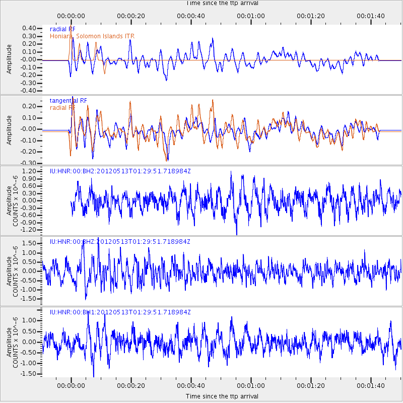
HNR Honiara, Solomon Islands - Earthquake Result Viewer
*The percent match for this event was below the threshold and hence no stack was calculated.
| Earthquake location: |
South Indian Ocean |
| Earthquake latitude/longitude: |
-3.3/89.4 |
| Earthquake time(UTC): |
2012/05/13 (134) 01:19:10 GMT |
| Earthquake Depth: |
12 km |
| Earthquake Magnitude: |
5.5 MW |
| Earthquake Catalog/Contributor: |
NEIC PDE/NEIC PDE-M |
|
| Network: |
IU Global Seismograph Network (GSN - IRIS/USGS) |
| Station: |
HNR Honiara, Solomon Islands |
| Lat/Lon: |
9.44 S/159.95 E |
| Elevation: |
100 m |
|
| Distance: |
70.3 deg |
| Az: |
98.774 deg |
| Baz: |
269.817 deg |
| Ray Param: |
$rayparam |
*The percent match for this event was below the threshold and hence was not used in the summary stack. |
|
| Radial Match: |
45.959263 % |
| Radial Bump: |
400 |
| Transverse Match: |
57.255516 % |
| Transverse Bump: |
400 |
| SOD ConfigId: |
558545 |
| Insert Time: |
2013-09-19 18:26:33.352 +0000 |
| GWidth: |
2.5 |
| Max Bumps: |
400 |
| Tol: |
0.001 |
|
Signal To Noise
| Channel | StoN | STA | LTA |
| IU:HNR:00:BHZ:20120513T01:29:51.718984Z | 2.3974128 | 7.20463E-7 | 3.005169E-7 |
| IU:HNR:00:BH1:20120513T01:29:51.718984Z | 0.9537573 | 3.1356745E-7 | 3.287707E-7 |
| IU:HNR:00:BH2:20120513T01:29:51.718984Z | 0.7954216 | 2.6283104E-7 | 3.3042983E-7 |
| Arrivals |
| Ps | |
| PpPs | |
| PsPs/PpSs | |


