You are here: Home > Network List > CU - Caribbean Network (USGS) Stations List
> Station BBGH Gun Hill, Barbados > Earthquake Result Viewer
BBGH Gun Hill, Barbados - Earthquake Result Viewer
*The percent match for this event was below the threshold and hence no stack was calculated.
| Earthquake location: |
Peru-Bolivia Border Region |
| Earthquake latitude/longitude: |
-17.7/-69.6 |
| Earthquake time(UTC): |
2012/05/14 (135) 10:00:40 GMT |
| Earthquake Depth: |
106 km |
| Earthquake Magnitude: |
6.4 MB, 6.2 MW, 6.2 MW |
| Earthquake Catalog/Contributor: |
WHDF/NEIC |
|
| Network: |
CU Caribbean Network (USGS) |
| Station: |
BBGH Gun Hill, Barbados |
| Lat/Lon: |
13.14 N/59.56 W |
| Elevation: |
180 m |
|
| Distance: |
32.2 deg |
| Az: |
18.577 deg |
| Baz: |
198.166 deg |
| Ray Param: |
$rayparam |
*The percent match for this event was below the threshold and hence was not used in the summary stack. |
|
| Radial Match: |
58.823708 % |
| Radial Bump: |
400 |
| Transverse Match: |
66.45144 % |
| Transverse Bump: |
400 |
| SOD ConfigId: |
558545 |
| Insert Time: |
2013-09-19 18:28:15.029 +0000 |
| GWidth: |
2.5 |
| Max Bumps: |
400 |
| Tol: |
0.001 |
|
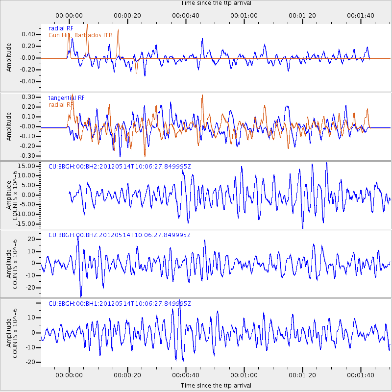
Signal To Noise
| Channel | StoN | STA | LTA |
| CU:BBGH:00:BHZ:20120514T10:06:27.849995Z | 2.972215 | 1.1493628E-5 | 3.8670246E-6 |
| CU:BBGH:00:BH1:20120514T10:06:27.849995Z | 0.6388331 | 2.0603327E-6 | 3.2251503E-6 |
| CU:BBGH:00:BH2:20120514T10:06:27.849995Z | 0.94191563 | 2.9457499E-6 | 3.127403E-6 |
| Arrivals |
| Ps | |
| PpPs | |
| PsPs/PpSs | |


