You are here: Home > Network List > US - United States National Seismic Network Stations List
> Station AMTX Amarillo, Texas, USA > Earthquake Result Viewer
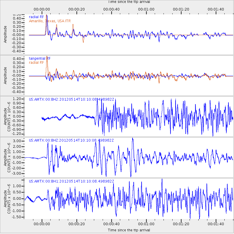
AMTX Amarillo, Texas, USA - Earthquake Result Viewer
*The percent match for this event was below the threshold and hence no stack was calculated.
| Earthquake location: |
Peru-Bolivia Border Region |
| Earthquake latitude/longitude: |
-17.7/-69.6 |
| Earthquake time(UTC): |
2012/05/14 (135) 10:00:40 GMT |
| Earthquake Depth: |
106 km |
| Earthquake Magnitude: |
6.4 MB, 6.2 MW, 6.2 MW |
| Earthquake Catalog/Contributor: |
WHDF/NEIC |
|
| Network: |
US United States National Seismic Network |
| Station: |
AMTX Amarillo, Texas, USA |
| Lat/Lon: |
34.53 N/101.41 W |
| Elevation: |
1010 m |
|
| Distance: |
60.1 deg |
| Az: |
329.86 deg |
| Baz: |
144.563 deg |
| Ray Param: |
$rayparam |
*The percent match for this event was below the threshold and hence was not used in the summary stack. |
|
| Radial Match: |
84.33383 % |
| Radial Bump: |
400 |
| Transverse Match: |
69.96001 % |
| Transverse Bump: |
400 |
| SOD ConfigId: |
558545 |
| Insert Time: |
2013-09-19 18:30:13.975 +0000 |
| GWidth: |
2.5 |
| Max Bumps: |
400 |
| Tol: |
0.001 |
|
Signal To Noise
| Channel | StoN | STA | LTA |
| US:AMTX:00:BHZ:20120514T10:10:08.498982Z | 10.355569 | 1.165463E-6 | 1.1254457E-7 |
| US:AMTX:00:BH1:20120514T10:10:08.498982Z | 2.8644063 | 3.0726144E-7 | 1.07268804E-7 |
| US:AMTX:00:BH2:20120514T10:10:08.498982Z | 4.2101684 | 3.7297735E-7 | 8.858966E-8 |
| Arrivals |
| Ps | |
| PpPs | |
| PsPs/PpSs | |


