You are here: Home > Network List > US - United States National Seismic Network Stations List
> Station HAWA Hanford, Washington, USA > Earthquake Result Viewer
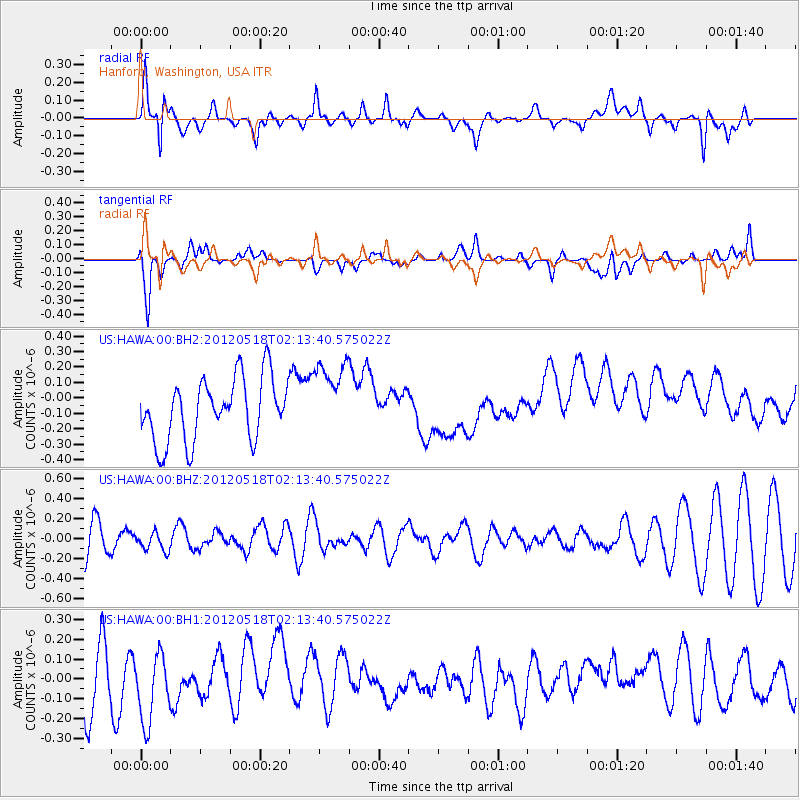
HAWA Hanford, Washington, USA - Earthquake Result Viewer
*The percent match for this event was below the threshold and hence no stack was calculated.
| Earthquake location: |
Off Coast Of Southern Chile |
| Earthquake latitude/longitude: |
-44.8/-80.2 |
| Earthquake time(UTC): |
2012/05/18 (139) 02:00:39 GMT |
| Earthquake Depth: |
10 km |
| Earthquake Magnitude: |
5.5 MB, 5.7 MS, 6.3 MW, 6.3 MW |
| Earthquake Catalog/Contributor: |
WHDF/NEIC |
|
| Network: |
US United States National Seismic Network |
| Station: |
HAWA Hanford, Washington, USA |
| Lat/Lon: |
46.39 N/119.53 W |
| Elevation: |
364 m |
|
| Distance: |
97.2 deg |
| Az: |
333.73 deg |
| Baz: |
152.921 deg |
| Ray Param: |
$rayparam |
*The percent match for this event was below the threshold and hence was not used in the summary stack. |
|
| Radial Match: |
46.942207 % |
| Radial Bump: |
400 |
| Transverse Match: |
45.463875 % |
| Transverse Bump: |
400 |
| SOD ConfigId: |
558545 |
| Insert Time: |
2013-09-19 18:37:14.649 +0000 |
| GWidth: |
2.5 |
| Max Bumps: |
400 |
| Tol: |
0.001 |
|
Signal To Noise
| Channel | StoN | STA | LTA |
| US:HAWA:00:BHZ:20120518T02:13:40.575022Z | 0.35155934 | 9.335586E-8 | 2.6554792E-7 |
| US:HAWA:00:BH1:20120518T02:13:40.575022Z | 1.1332585 | 1.7951035E-7 | 1.5840195E-7 |
| US:HAWA:00:BH2:20120518T02:13:40.575022Z | 1.2307053 | 2.468413E-7 | 2.0056898E-7 |
| Arrivals |
| Ps | |
| PpPs | |
| PsPs/PpSs | |


