You are here: Home > Network List > US - United States National Seismic Network Stations List
> Station DGMT Dagmar, Montana, USA > Earthquake Result Viewer
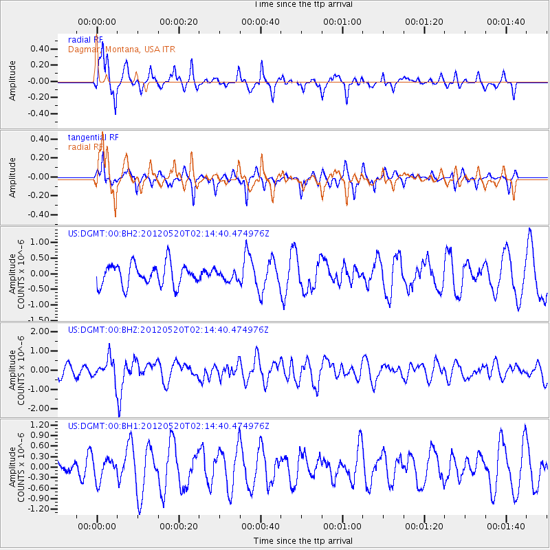
DGMT Dagmar, Montana, USA - Earthquake Result Viewer
*The percent match for this event was below the threshold and hence no stack was calculated.
| Earthquake location: |
Northern Italy |
| Earthquake latitude/longitude: |
44.9/11.2 |
| Earthquake time(UTC): |
2012/05/20 (141) 02:03:52 GMT |
| Earthquake Depth: |
6.3 km |
| Earthquake Magnitude: |
5.8 MB, 6.0 MS, 6.0 MW, 6.1 MW |
| Earthquake Catalog/Contributor: |
WHDF/NEIC |
|
| Network: |
US United States National Seismic Network |
| Station: |
DGMT Dagmar, Montana, USA |
| Lat/Lon: |
48.47 N/104.20 W |
| Elevation: |
0.0 m |
|
| Distance: |
71.2 deg |
| Az: |
320.592 deg |
| Baz: |
42.693 deg |
| Ray Param: |
$rayparam |
*The percent match for this event was below the threshold and hence was not used in the summary stack. |
|
| Radial Match: |
75.37969 % |
| Radial Bump: |
316 |
| Transverse Match: |
53.763386 % |
| Transverse Bump: |
292 |
| SOD ConfigId: |
558545 |
| Insert Time: |
2013-09-19 18:49:13.816 +0000 |
| GWidth: |
2.5 |
| Max Bumps: |
400 |
| Tol: |
0.001 |
|
Signal To Noise
| Channel | StoN | STA | LTA |
| US:DGMT:00:BHZ:20120520T02:14:40.474976Z | 2.1390133 | 5.8794535E-7 | 2.7486755E-7 |
| US:DGMT:00:BH1:20120520T02:14:40.474976Z | 0.5833559 | 3.0714554E-7 | 5.2651484E-7 |
| US:DGMT:00:BH2:20120520T02:14:40.474976Z | 0.4352082 | 1.5089137E-7 | 3.4671078E-7 |
| Arrivals |
| Ps | |
| PpPs | |
| PsPs/PpSs | |


