You are here: Home > Network List > US - United States National Seismic Network Stations List
> Station EGMT Eagleton, Montana, USA > Earthquake Result Viewer
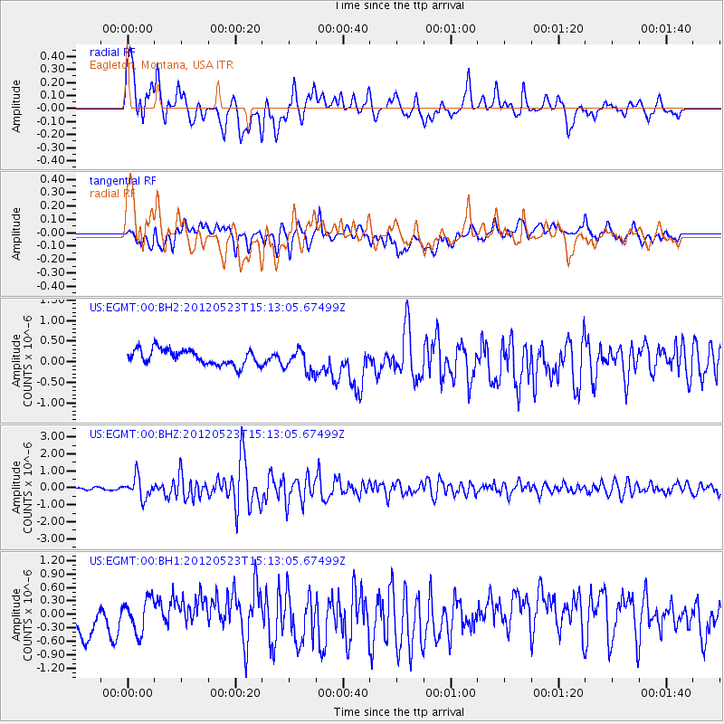
EGMT Eagleton, Montana, USA - Earthquake Result Viewer
*The percent match for this event was below the threshold and hence no stack was calculated.
| Earthquake location: |
Hokkaido, Japan Region |
| Earthquake latitude/longitude: |
41.3/142.1 |
| Earthquake time(UTC): |
2012/05/23 (144) 15:02:25 GMT |
| Earthquake Depth: |
46 km |
| Earthquake Magnitude: |
6.2 MB, 5.5 MS, 5.9 MW, 6.0 MW |
| Earthquake Catalog/Contributor: |
WHDF/NEIC |
|
| Network: |
US United States National Seismic Network |
| Station: |
EGMT Eagleton, Montana, USA |
| Lat/Lon: |
48.02 N/109.75 W |
| Elevation: |
1055 m |
|
| Distance: |
70.7 deg |
| Az: |
42.51 deg |
| Baz: |
310.71 deg |
| Ray Param: |
$rayparam |
*The percent match for this event was below the threshold and hence was not used in the summary stack. |
|
| Radial Match: |
74.56134 % |
| Radial Bump: |
400 |
| Transverse Match: |
52.56913 % |
| Transverse Bump: |
400 |
| SOD ConfigId: |
558545 |
| Insert Time: |
2013-09-19 19:02:08.194 +0000 |
| GWidth: |
2.5 |
| Max Bumps: |
400 |
| Tol: |
0.001 |
|
Signal To Noise
| Channel | StoN | STA | LTA |
| US:EGMT:00:BHZ:20120523T15:13:05.67499Z | 7.445782 | 6.271905E-7 | 8.423434E-8 |
| US:EGMT:00:BH1:20120523T15:13:05.67499Z | 0.9352037 | 3.7110414E-7 | 3.968164E-7 |
| US:EGMT:00:BH2:20120523T15:13:05.67499Z | 1.5139468 | 2.7921766E-7 | 1.844303E-7 |
| Arrivals |
| Ps | |
| PpPs | |
| PsPs/PpSs | |


