You are here: Home > Network List > IU - Global Seismograph Network (GSN - IRIS/USGS) Stations List
> Station RSSD Black Hills, South Dakota, USA > Earthquake Result Viewer
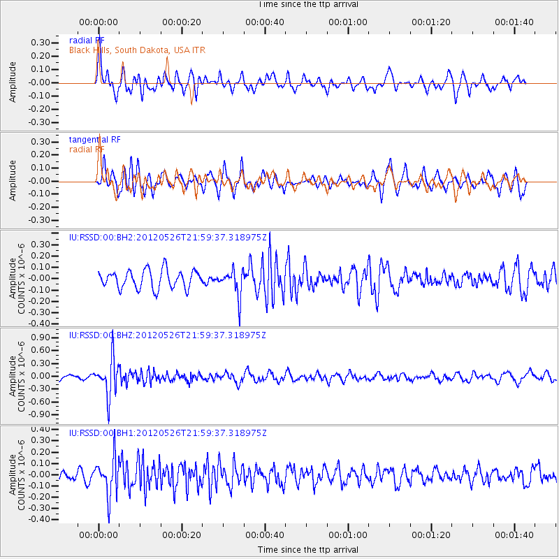
RSSD Black Hills, South Dakota, USA - Earthquake Result Viewer
*The percent match for this event was below the threshold and hence no stack was calculated.
| Earthquake location: |
Bonin Islands, Japan Region |
| Earthquake latitude/longitude: |
26.9/140.1 |
| Earthquake time(UTC): |
2012/05/26 (147) 21:48:10 GMT |
| Earthquake Depth: |
487 km |
| Earthquake Magnitude: |
5.5 MB, 6.0 MW, 6.0 MW |
| Earthquake Catalog/Contributor: |
WHDF/NEIC |
|
| Network: |
IU Global Seismograph Network (GSN - IRIS/USGS) |
| Station: |
RSSD Black Hills, South Dakota, USA |
| Lat/Lon: |
44.12 N/104.04 W |
| Elevation: |
2090 m |
|
| Distance: |
88.2 deg |
| Az: |
40.401 deg |
| Baz: |
306.526 deg |
| Ray Param: |
$rayparam |
*The percent match for this event was below the threshold and hence was not used in the summary stack. |
|
| Radial Match: |
64.62883 % |
| Radial Bump: |
400 |
| Transverse Match: |
58.36518 % |
| Transverse Bump: |
300 |
| SOD ConfigId: |
558545 |
| Insert Time: |
2013-09-19 19:12:28.216 +0000 |
| GWidth: |
2.5 |
| Max Bumps: |
400 |
| Tol: |
0.001 |
|
Signal To Noise
| Channel | StoN | STA | LTA |
| IU:RSSD:00:BHZ:20120526T21:59:37.318975Z | 9.762836 | 4.44053E-7 | 4.548401E-8 |
| IU:RSSD:00:BH1:20120526T21:59:37.318975Z | 4.020738 | 1.7028256E-7 | 4.2351072E-8 |
| IU:RSSD:00:BH2:20120526T21:59:37.318975Z | 1.5081817 | 1.2115221E-7 | 8.032998E-8 |
| Arrivals |
| Ps | |
| PpPs | |
| PsPs/PpSs | |


