You are here: Home > Network List > US - United States National Seismic Network Stations List
> Station DGMT Dagmar, Montana, USA > Earthquake Result Viewer
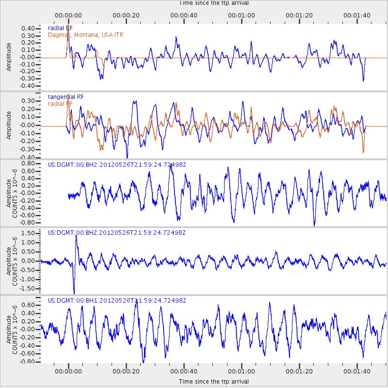
DGMT Dagmar, Montana, USA - Earthquake Result Viewer
*The percent match for this event was below the threshold and hence no stack was calculated.
| Earthquake location: |
Bonin Islands, Japan Region |
| Earthquake latitude/longitude: |
26.9/140.1 |
| Earthquake time(UTC): |
2012/05/26 (147) 21:48:10 GMT |
| Earthquake Depth: |
487 km |
| Earthquake Magnitude: |
5.5 MB, 6.0 MW, 6.0 MW |
| Earthquake Catalog/Contributor: |
WHDF/NEIC |
|
| Network: |
US United States National Seismic Network |
| Station: |
DGMT Dagmar, Montana, USA |
| Lat/Lon: |
48.47 N/104.20 W |
| Elevation: |
0.0 m |
|
| Distance: |
85.5 deg |
| Az: |
36.959 deg |
| Baz: |
306.223 deg |
| Ray Param: |
$rayparam |
*The percent match for this event was below the threshold and hence was not used in the summary stack. |
|
| Radial Match: |
33.20817 % |
| Radial Bump: |
400 |
| Transverse Match: |
69.14334 % |
| Transverse Bump: |
400 |
| SOD ConfigId: |
558545 |
| Insert Time: |
2013-09-19 19:12:53.184 +0000 |
| GWidth: |
2.5 |
| Max Bumps: |
400 |
| Tol: |
0.001 |
|
Signal To Noise
| Channel | StoN | STA | LTA |
| US:DGMT:00:BHZ:20120526T21:59:24.72498Z | 4.667814 | 6.332031E-7 | 1.3565302E-7 |
| US:DGMT:00:BH1:20120526T21:59:24.72498Z | 1.757905 | 3.533891E-7 | 2.0102856E-7 |
| US:DGMT:00:BH2:20120526T21:59:24.72498Z | 1.4748391 | 2.3931577E-7 | 1.6226568E-7 |
| Arrivals |
| Ps | |
| PpPs | |
| PsPs/PpSs | |


