You are here: Home > Network List > US - United States National Seismic Network Stations List
> Station DUG Dugway, Tooele County, Utah, USA > Earthquake Result Viewer
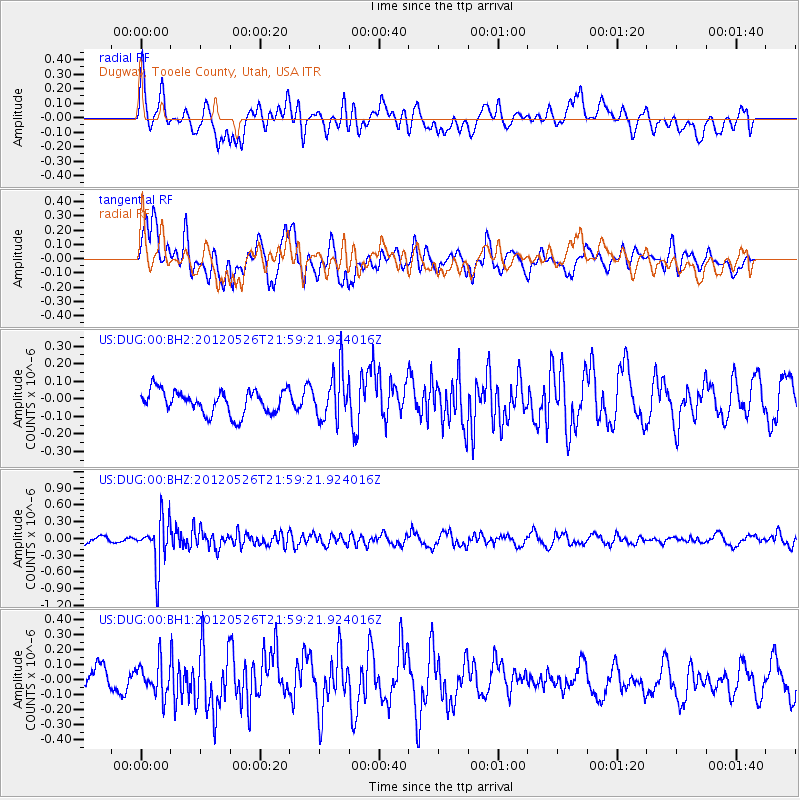
DUG Dugway, Tooele County, Utah, USA - Earthquake Result Viewer
*The percent match for this event was below the threshold and hence no stack was calculated.
| Earthquake location: |
Bonin Islands, Japan Region |
| Earthquake latitude/longitude: |
26.9/140.1 |
| Earthquake time(UTC): |
2012/05/26 (147) 21:48:10 GMT |
| Earthquake Depth: |
487 km |
| Earthquake Magnitude: |
5.5 MB, 6.0 MW, 6.0 MW |
| Earthquake Catalog/Contributor: |
WHDF/NEIC |
|
| Network: |
US United States National Seismic Network |
| Station: |
DUG Dugway, Tooele County, Utah, USA |
| Lat/Lon: |
40.19 N/112.81 W |
| Elevation: |
1477 m |
|
| Distance: |
85.0 deg |
| Az: |
47.294 deg |
| Baz: |
301.059 deg |
| Ray Param: |
$rayparam |
*The percent match for this event was below the threshold and hence was not used in the summary stack. |
|
| Radial Match: |
44.834618 % |
| Radial Bump: |
400 |
| Transverse Match: |
73.55362 % |
| Transverse Bump: |
400 |
| SOD ConfigId: |
558545 |
| Insert Time: |
2013-09-19 19:12:54.107 +0000 |
| GWidth: |
2.5 |
| Max Bumps: |
400 |
| Tol: |
0.001 |
|
Signal To Noise
| Channel | StoN | STA | LTA |
| US:DUG:00:BHZ:20120526T21:59:21.924016Z | 6.627842 | 4.3294168E-7 | 6.5321665E-8 |
| US:DUG:00:BH1:20120526T21:59:21.924016Z | 1.484421 | 1.07754225E-7 | 7.259007E-8 |
| US:DUG:00:BH2:20120526T21:59:21.924016Z | 2.0426455 | 1.3694054E-7 | 6.704078E-8 |
| Arrivals |
| Ps | |
| PpPs | |
| PsPs/PpSs | |


