You are here: Home > Network List > US - United States National Seismic Network Stations List
> Station EGMT Eagleton, Montana, USA > Earthquake Result Viewer
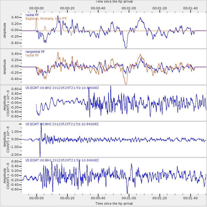
EGMT Eagleton, Montana, USA - Earthquake Result Viewer
*The percent match for this event was below the threshold and hence no stack was calculated.
| Earthquake location: |
Bonin Islands, Japan Region |
| Earthquake latitude/longitude: |
26.9/140.1 |
| Earthquake time(UTC): |
2012/05/26 (147) 21:48:10 GMT |
| Earthquake Depth: |
487 km |
| Earthquake Magnitude: |
5.5 MB, 6.0 MW, 6.0 MW |
| Earthquake Catalog/Contributor: |
WHDF/NEIC |
|
| Network: |
US United States National Seismic Network |
| Station: |
EGMT Eagleton, Montana, USA |
| Lat/Lon: |
48.02 N/109.75 W |
| Elevation: |
1055 m |
|
| Distance: |
82.7 deg |
| Az: |
39.433 deg |
| Baz: |
302.34 deg |
| Ray Param: |
$rayparam |
*The percent match for this event was below the threshold and hence was not used in the summary stack. |
|
| Radial Match: |
42.962795 % |
| Radial Bump: |
400 |
| Transverse Match: |
44.54683 % |
| Transverse Bump: |
400 |
| SOD ConfigId: |
558545 |
| Insert Time: |
2013-09-19 19:13:02.908 +0000 |
| GWidth: |
2.5 |
| Max Bumps: |
400 |
| Tol: |
0.001 |
|
Signal To Noise
| Channel | StoN | STA | LTA |
| US:EGMT:00:BHZ:20120526T21:59:10.84998Z | 12.018764 | 7.6226894E-7 | 6.342324E-8 |
| US:EGMT:00:BH1:20120526T21:59:10.84998Z | 0.98926806 | 2.467413E-7 | 2.4941804E-7 |
| US:EGMT:00:BH2:20120526T21:59:10.84998Z | 1.3013573 | 2.439517E-7 | 1.8745942E-7 |
| Arrivals |
| Ps | |
| PpPs | |
| PsPs/PpSs | |


