You are here: Home > Network List > US - United States National Seismic Network Stations List
> Station EYMN Ely, Minnesota, USA > Earthquake Result Viewer
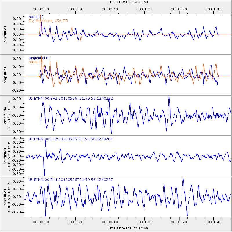
EYMN Ely, Minnesota, USA - Earthquake Result Viewer
*The percent match for this event was below the threshold and hence no stack was calculated.
| Earthquake location: |
Bonin Islands, Japan Region |
| Earthquake latitude/longitude: |
26.9/140.1 |
| Earthquake time(UTC): |
2012/05/26 (147) 21:48:10 GMT |
| Earthquake Depth: |
487 km |
| Earthquake Magnitude: |
5.5 MB, 6.0 MW, 6.0 MW |
| Earthquake Catalog/Contributor: |
WHDF/NEIC |
|
| Network: |
US United States National Seismic Network |
| Station: |
EYMN Ely, Minnesota, USA |
| Lat/Lon: |
47.95 N/91.50 W |
| Elevation: |
475 m |
|
| Distance: |
92.3 deg |
| Az: |
31.799 deg |
| Baz: |
315.584 deg |
| Ray Param: |
$rayparam |
*The percent match for this event was below the threshold and hence was not used in the summary stack. |
|
| Radial Match: |
64.70793 % |
| Radial Bump: |
400 |
| Transverse Match: |
48.437866 % |
| Transverse Bump: |
400 |
| SOD ConfigId: |
558545 |
| Insert Time: |
2013-09-19 19:13:04.162 +0000 |
| GWidth: |
2.5 |
| Max Bumps: |
400 |
| Tol: |
0.001 |
|
Signal To Noise
| Channel | StoN | STA | LTA |
| US:EYMN:00:BHZ:20120526T21:59:56.124028Z | 3.8929496 | 3.0977625E-7 | 7.957366E-8 |
| US:EYMN:00:BH1:20120526T21:59:56.124028Z | 2.0790148 | 1.17124486E-7 | 5.6336532E-8 |
| US:EYMN:00:BH2:20120526T21:59:56.124028Z | 1.1993291 | 8.934289E-8 | 7.4494054E-8 |
| Arrivals |
| Ps | |
| PpPs | |
| PsPs/PpSs | |


