You are here: Home > Network List > US - United States National Seismic Network Stations List
> Station HLID Hailey, Idaho, USA > Earthquake Result Viewer
HLID Hailey, Idaho, USA - Earthquake Result Viewer
*The percent match for this event was below the threshold and hence no stack was calculated.
| Earthquake location: |
Bonin Islands, Japan Region |
| Earthquake latitude/longitude: |
26.9/140.1 |
| Earthquake time(UTC): |
2012/05/26 (147) 21:48:10 GMT |
| Earthquake Depth: |
487 km |
| Earthquake Magnitude: |
5.5 MB, 6.0 MW, 6.0 MW |
| Earthquake Catalog/Contributor: |
WHDF/NEIC |
|
| Network: |
US United States National Seismic Network |
| Station: |
HLID Hailey, Idaho, USA |
| Lat/Lon: |
43.56 N/114.41 W |
| Elevation: |
1772 m |
|
| Distance: |
82.2 deg |
| Az: |
44.982 deg |
| Baz: |
299.736 deg |
| Ray Param: |
$rayparam |
*The percent match for this event was below the threshold and hence was not used in the summary stack. |
|
| Radial Match: |
62.105003 % |
| Radial Bump: |
400 |
| Transverse Match: |
48.99628 % |
| Transverse Bump: |
400 |
| SOD ConfigId: |
558545 |
| Insert Time: |
2013-09-19 19:13:09.141 +0000 |
| GWidth: |
2.5 |
| Max Bumps: |
400 |
| Tol: |
0.001 |
|
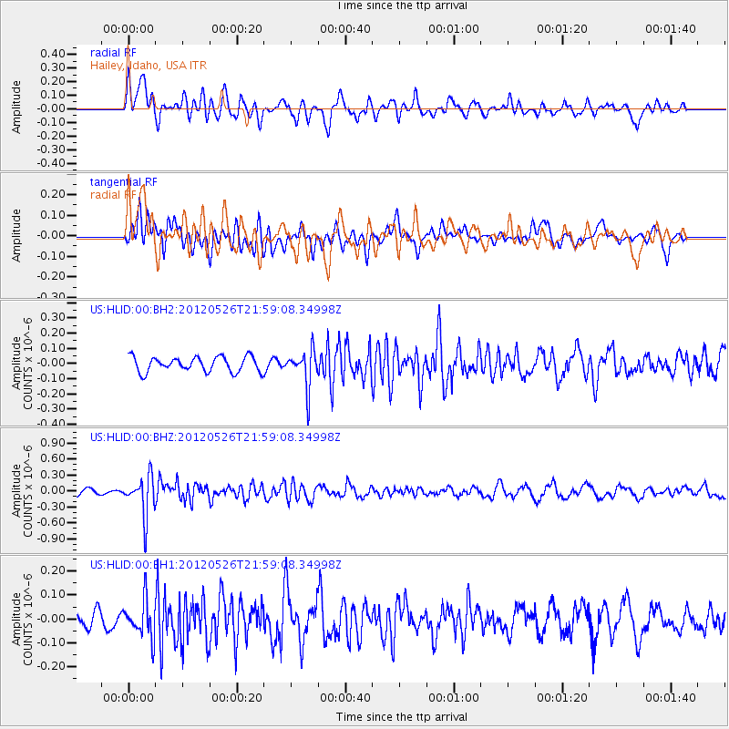
Signal To Noise
| Channel | StoN | STA | LTA |
| US:HLID:00:BHZ:20120526T21:59:08.34998Z | 6.246409 | 3.7192288E-7 | 5.954187E-8 |
| US:HLID:00:BH1:20120526T21:59:08.34998Z | 1.2889913 | 7.8557456E-8 | 6.0944906E-8 |
| US:HLID:00:BH2:20120526T21:59:08.34998Z | 2.4754345 | 1.210046E-7 | 4.8882168E-8 |
| Arrivals |
| Ps | |
| PpPs | |
| PsPs/PpSs | |


