You are here: Home > Network List > US - United States National Seismic Network Stations List
> Station MSO Missoula, Montana, USA > Earthquake Result Viewer
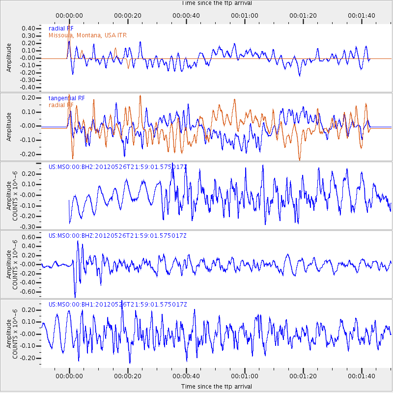
MSO Missoula, Montana, USA - Earthquake Result Viewer
*The percent match for this event was below the threshold and hence no stack was calculated.
| Earthquake location: |
Bonin Islands, Japan Region |
| Earthquake latitude/longitude: |
26.9/140.1 |
| Earthquake time(UTC): |
2012/05/26 (147) 21:48:10 GMT |
| Earthquake Depth: |
487 km |
| Earthquake Magnitude: |
5.5 MB, 6.0 MW, 6.0 MW |
| Earthquake Catalog/Contributor: |
WHDF/NEIC |
|
| Network: |
US United States National Seismic Network |
| Station: |
MSO Missoula, Montana, USA |
| Lat/Lon: |
46.83 N/113.94 W |
| Elevation: |
1264 m |
|
| Distance: |
80.9 deg |
| Az: |
41.946 deg |
| Baz: |
299.625 deg |
| Ray Param: |
$rayparam |
*The percent match for this event was below the threshold and hence was not used in the summary stack. |
|
| Radial Match: |
40.060104 % |
| Radial Bump: |
400 |
| Transverse Match: |
41.907845 % |
| Transverse Bump: |
400 |
| SOD ConfigId: |
558545 |
| Insert Time: |
2013-09-19 19:13:21.889 +0000 |
| GWidth: |
2.5 |
| Max Bumps: |
400 |
| Tol: |
0.001 |
|
Signal To Noise
| Channel | StoN | STA | LTA |
| US:MSO:00:BHZ:20120526T21:59:01.575017Z | 4.971143 | 2.9812873E-7 | 5.9971875E-8 |
| US:MSO:00:BH1:20120526T21:59:01.575017Z | 1.5092311 | 1.313172E-7 | 8.700934E-8 |
| US:MSO:00:BH2:20120526T21:59:01.575017Z | 1.3595368 | 1.1907253E-7 | 8.758316E-8 |
| Arrivals |
| Ps | |
| PpPs | |
| PsPs/PpSs | |


