You are here: Home > Network List > US - United States National Seismic Network Stations List
> Station DUG Dugway, Tooele County, Utah, USA > Earthquake Result Viewer
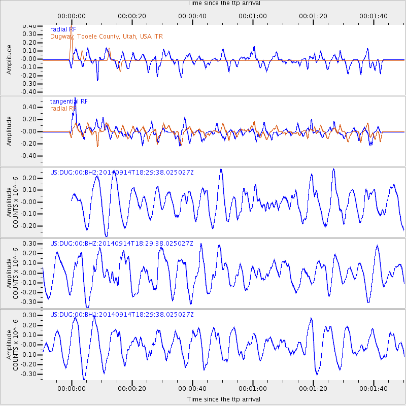
DUG Dugway, Tooele County, Utah, USA - Earthquake Result Viewer
*The percent match for this event was below the threshold and hence no stack was calculated.
| Earthquake location: |
Tonga Islands |
| Earthquake latitude/longitude: |
-21.4/-174.4 |
| Earthquake time(UTC): |
2014/09/14 (257) 18:17:44 GMT |
| Earthquake Depth: |
49 km |
| Earthquake Magnitude: |
5.7 MW |
| Earthquake Catalog/Contributor: |
ISC/ISC |
|
| Network: |
US United States National Seismic Network |
| Station: |
DUG Dugway, Tooele County, Utah, USA |
| Lat/Lon: |
40.19 N/112.81 W |
| Elevation: |
1477 m |
|
| Distance: |
83.9 deg |
| Az: |
42.669 deg |
| Baz: |
235.559 deg |
| Ray Param: |
$rayparam |
*The percent match for this event was below the threshold and hence was not used in the summary stack. |
|
| Radial Match: |
45.15635 % |
| Radial Bump: |
400 |
| Transverse Match: |
65.48362 % |
| Transverse Bump: |
400 |
| SOD ConfigId: |
3390531 |
| Insert Time: |
2019-04-14 01:25:06.545 +0000 |
| GWidth: |
2.5 |
| Max Bumps: |
400 |
| Tol: |
0.001 |
|
Signal To Noise
| Channel | StoN | STA | LTA |
| US:DUG:00:BHZ:20140914T18:29:38.025027Z | 1.3020551 | 1.6584691E-7 | 1.2737318E-7 |
| US:DUG:00:BH1:20140914T18:29:38.025027Z | 3.4043999 | 2.2312345E-7 | 6.553974E-8 |
| US:DUG:00:BH2:20140914T18:29:38.025027Z | 0.47125807 | 6.5427216E-8 | 1.388352E-7 |
| Arrivals |
| Ps | |
| PpPs | |
| PsPs/PpSs | |


