You are here: Home > Network List > US - United States National Seismic Network Stations List
> Station WMOK Wichita Mountains, Oklahoma, USA > Earthquake Result Viewer
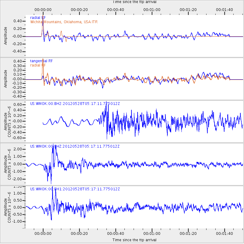
WMOK Wichita Mountains, Oklahoma, USA - Earthquake Result Viewer
*The percent match for this event was below the threshold and hence no stack was calculated.
| Earthquake location: |
Santiago Del Estero Prov., Arg. |
| Earthquake latitude/longitude: |
-28.0/-63.1 |
| Earthquake time(UTC): |
2012/05/28 (149) 05:07:23 GMT |
| Earthquake Depth: |
587 km |
| Earthquake Magnitude: |
6.0 MB, 6.7 MW, 6.8 MW |
| Earthquake Catalog/Contributor: |
WHDF/NEIC |
|
| Network: |
US United States National Seismic Network |
| Station: |
WMOK Wichita Mountains, Oklahoma, USA |
| Lat/Lon: |
34.74 N/98.78 W |
| Elevation: |
486 m |
|
| Distance: |
71.0 deg |
| Az: |
329.457 deg |
| Baz: |
146.947 deg |
| Ray Param: |
$rayparam |
*The percent match for this event was below the threshold and hence was not used in the summary stack. |
|
| Radial Match: |
76.58412 % |
| Radial Bump: |
400 |
| Transverse Match: |
60.465775 % |
| Transverse Bump: |
400 |
| SOD ConfigId: |
558545 |
| Insert Time: |
2013-09-19 19:17:58.184 +0000 |
| GWidth: |
2.5 |
| Max Bumps: |
400 |
| Tol: |
0.001 |
|
Signal To Noise
| Channel | StoN | STA | LTA |
| US:WMOK:00:BHZ:20120528T05:17:11.775012Z | 8.034039 | 9.0336556E-7 | 1.12442265E-7 |
| US:WMOK:00:BH1:20120528T05:17:11.775012Z | 3.3181403 | 3.0856123E-7 | 9.299222E-8 |
| US:WMOK:00:BH2:20120528T05:17:11.775012Z | 2.7611427 | 2.2663477E-7 | 8.2080064E-8 |
| Arrivals |
| Ps | |
| PpPs | |
| PsPs/PpSs | |


