You are here: Home > Network List > II - Global Seismograph Network (GSN - IRIS/IDA) Stations List
> Station WRAB Tennant Creek, NT, Australia > Earthquake Result Viewer
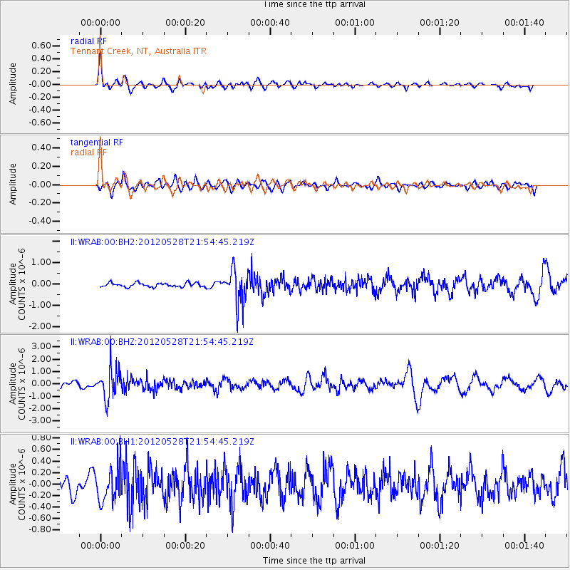
WRAB Tennant Creek, NT, Australia - Earthquake Result Viewer
*The percent match for this event was below the threshold and hence no stack was calculated.
| Earthquake location: |
Tonga Islands |
| Earthquake latitude/longitude: |
-20.0/-176.0 |
| Earthquake time(UTC): |
2012/05/28 (149) 21:47:09 GMT |
| Earthquake Depth: |
211 km |
| Earthquake Magnitude: |
5.9 MW, 5.3 MB, 5.9 MW |
| Earthquake Catalog/Contributor: |
WHDF/NEIC |
|
| Network: |
II Global Seismograph Network (GSN - IRIS/IDA) |
| Station: |
WRAB Tennant Creek, NT, Australia |
| Lat/Lon: |
19.93 S/134.36 E |
| Elevation: |
366 m |
|
| Distance: |
46.5 deg |
| Az: |
261.113 deg |
| Baz: |
98.951 deg |
| Ray Param: |
$rayparam |
*The percent match for this event was below the threshold and hence was not used in the summary stack. |
|
| Radial Match: |
72.76582 % |
| Radial Bump: |
352 |
| Transverse Match: |
59.84959 % |
| Transverse Bump: |
400 |
| SOD ConfigId: |
558545 |
| Insert Time: |
2013-09-19 19:19:29.854 +0000 |
| GWidth: |
2.5 |
| Max Bumps: |
400 |
| Tol: |
0.001 |
|
Signal To Noise
| Channel | StoN | STA | LTA |
| II:WRAB:00:BHZ:20120528T21:54:45.219Z | 4.812535 | 1.2346868E-6 | 2.5655643E-7 |
| II:WRAB:00:BH1:20120528T21:54:45.219Z | 1.6722037 | 2.940813E-7 | 1.7586451E-7 |
| II:WRAB:00:BH2:20120528T21:54:45.219Z | 8.374328 | 7.8238224E-7 | 9.342627E-8 |
| Arrivals |
| Ps | |
| PpPs | |
| PsPs/PpSs | |


