You are here: Home > Network List > US - United States National Seismic Network Stations List
> Station AMTX Amarillo, Texas, USA > Earthquake Result Viewer
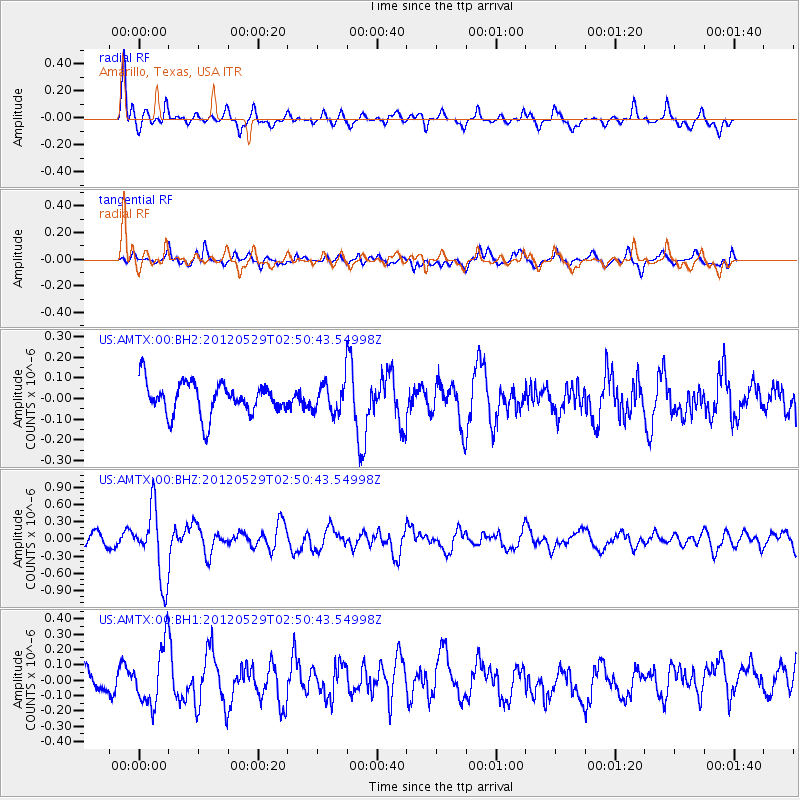
AMTX Amarillo, Texas, USA - Earthquake Result Viewer
*The percent match for this event was below the threshold and hence no stack was calculated.
| Earthquake location: |
Komandorskiye Ostrova Region |
| Earthquake latitude/longitude: |
54.4/168.9 |
| Earthquake time(UTC): |
2012/05/29 (150) 02:40:53 GMT |
| Earthquake Depth: |
10 km |
| Earthquake Magnitude: |
5.5 MS, 5.4 MB, 5.6 MW, 5.6 MW |
| Earthquake Catalog/Contributor: |
WHDF/NEIC |
|
| Network: |
US United States National Seismic Network |
| Station: |
AMTX Amarillo, Texas, USA |
| Lat/Lon: |
34.53 N/101.41 W |
| Elevation: |
1010 m |
|
| Distance: |
62.6 deg |
| Az: |
68.435 deg |
| Baz: |
318.764 deg |
| Ray Param: |
$rayparam |
*The percent match for this event was below the threshold and hence was not used in the summary stack. |
|
| Radial Match: |
81.787285 % |
| Radial Bump: |
400 |
| Transverse Match: |
64.6628 % |
| Transverse Bump: |
400 |
| SOD ConfigId: |
558545 |
| Insert Time: |
2013-09-19 19:23:32.600 +0000 |
| GWidth: |
2.5 |
| Max Bumps: |
400 |
| Tol: |
0.001 |
|
Signal To Noise
| Channel | StoN | STA | LTA |
| US:AMTX:00:BHZ:20120529T02:50:43.54998Z | 6.6572113 | 6.1439755E-7 | 9.2290534E-8 |
| US:AMTX:00:BH1:20120529T02:50:43.54998Z | 2.5491152 | 1.965747E-7 | 7.7114876E-8 |
| US:AMTX:00:BH2:20120529T02:50:43.54998Z | 2.3946726 | 1.6437653E-7 | 6.864259E-8 |
| Arrivals |
| Ps | |
| PpPs | |
| PsPs/PpSs | |


