You are here: Home > Network List > US - United States National Seismic Network Stations List
> Station EGMT Eagleton, Montana, USA > Earthquake Result Viewer
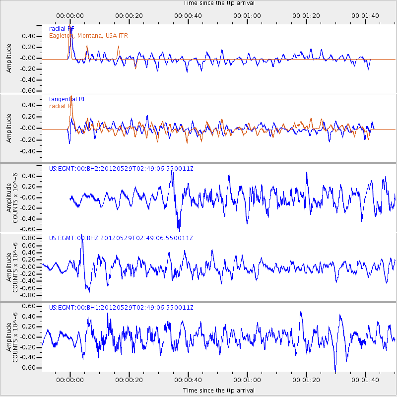
EGMT Eagleton, Montana, USA - Earthquake Result Viewer
*The percent match for this event was below the threshold and hence no stack was calculated.
| Earthquake location: |
Komandorskiye Ostrova Region |
| Earthquake latitude/longitude: |
54.4/168.9 |
| Earthquake time(UTC): |
2012/05/29 (150) 02:40:53 GMT |
| Earthquake Depth: |
10 km |
| Earthquake Magnitude: |
5.5 MS, 5.4 MB, 5.6 MW, 5.6 MW |
| Earthquake Catalog/Contributor: |
WHDF/NEIC |
|
| Network: |
US United States National Seismic Network |
| Station: |
EGMT Eagleton, Montana, USA |
| Lat/Lon: |
48.02 N/109.75 W |
| Elevation: |
1055 m |
|
| Distance: |
48.7 deg |
| Az: |
62.087 deg |
| Baz: |
309.622 deg |
| Ray Param: |
$rayparam |
*The percent match for this event was below the threshold and hence was not used in the summary stack. |
|
| Radial Match: |
65.98997 % |
| Radial Bump: |
400 |
| Transverse Match: |
55.98415 % |
| Transverse Bump: |
400 |
| SOD ConfigId: |
558545 |
| Insert Time: |
2013-09-19 19:24:06.126 +0000 |
| GWidth: |
2.5 |
| Max Bumps: |
400 |
| Tol: |
0.001 |
|
Signal To Noise
| Channel | StoN | STA | LTA |
| US:EGMT:00:BHZ:20120529T02:49:06.550011Z | 5.196641 | 3.228526E-7 | 6.212717E-8 |
| US:EGMT:00:BH1:20120529T02:49:06.550011Z | 1.3637638 | 1.666585E-7 | 1.2220481E-7 |
| US:EGMT:00:BH2:20120529T02:49:06.550011Z | 2.3309836 | 2.0060497E-7 | 8.6060226E-8 |
| Arrivals |
| Ps | |
| PpPs | |
| PsPs/PpSs | |


