You are here: Home > Network List > US - United States National Seismic Network Stations List
> Station HAWA Hanford, Washington, USA > Earthquake Result Viewer
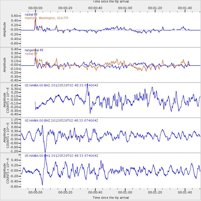
HAWA Hanford, Washington, USA - Earthquake Result Viewer
*The percent match for this event was below the threshold and hence no stack was calculated.
| Earthquake location: |
Komandorskiye Ostrova Region |
| Earthquake latitude/longitude: |
54.4/168.9 |
| Earthquake time(UTC): |
2012/05/29 (150) 02:40:53 GMT |
| Earthquake Depth: |
10 km |
| Earthquake Magnitude: |
5.5 MS, 5.4 MB, 5.6 MW, 5.6 MW |
| Earthquake Catalog/Contributor: |
WHDF/NEIC |
|
| Network: |
US United States National Seismic Network |
| Station: |
HAWA Hanford, Washington, USA |
| Lat/Lon: |
46.39 N/119.53 W |
| Elevation: |
364 m |
|
| Distance: |
44.5 deg |
| Az: |
69.563 deg |
| Baz: |
307.606 deg |
| Ray Param: |
$rayparam |
*The percent match for this event was below the threshold and hence was not used in the summary stack. |
|
| Radial Match: |
64.47315 % |
| Radial Bump: |
400 |
| Transverse Match: |
62.28807 % |
| Transverse Bump: |
400 |
| SOD ConfigId: |
558545 |
| Insert Time: |
2013-09-19 19:24:14.559 +0000 |
| GWidth: |
2.5 |
| Max Bumps: |
400 |
| Tol: |
0.001 |
|
Signal To Noise
| Channel | StoN | STA | LTA |
| US:HAWA:00:BHZ:20120529T02:48:33.674004Z | 2.4470923 | 3.6960742E-7 | 1.5103943E-7 |
| US:HAWA:00:BH1:20120529T02:48:33.674004Z | 2.842974 | 1.8863857E-7 | 6.635255E-8 |
| US:HAWA:00:BH2:20120529T02:48:33.674004Z | 1.5653878 | 1.5530208E-7 | 9.920996E-8 |
| Arrivals |
| Ps | |
| PpPs | |
| PsPs/PpSs | |


