You are here: Home > Network List > TA - USArray Transportable Network (new EarthScope stations) Stations List
> Station POKR Poker Plat Research Range, AK, USA > Earthquake Result Viewer
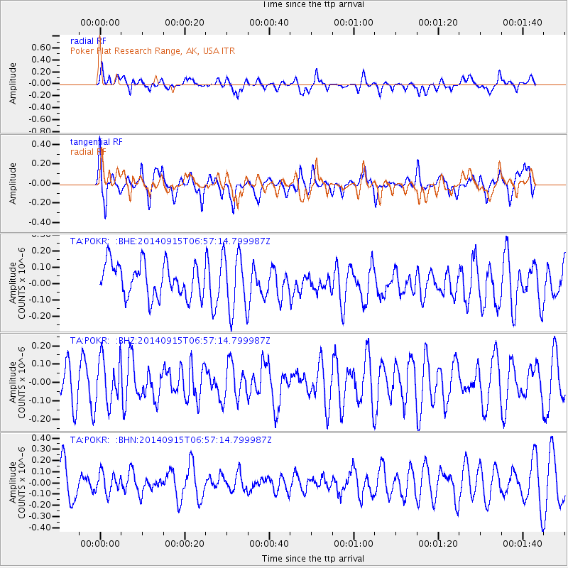
POKR Poker Plat Research Range, AK, USA - Earthquake Result Viewer
*The percent match for this event was below the threshold and hence no stack was calculated.
| Earthquake location: |
Gulf Of California |
| Earthquake latitude/longitude: |
30.6/-114.2 |
| Earthquake time(UTC): |
2014/09/15 (258) 06:50:09 GMT |
| Earthquake Depth: |
10 km |
| Earthquake Magnitude: |
5.0 MW |
| Earthquake Catalog/Contributor: |
ISC/ISC |
|
| Network: |
TA USArray Transportable Network (new EarthScope stations) |
| Station: |
POKR Poker Plat Research Range, AK, USA |
| Lat/Lon: |
65.12 N/147.43 W |
| Elevation: |
501 m |
|
| Distance: |
40.2 deg |
| Az: |
338.969 deg |
| Baz: |
132.977 deg |
| Ray Param: |
$rayparam |
*The percent match for this event was below the threshold and hence was not used in the summary stack. |
|
| Radial Match: |
46.04008 % |
| Radial Bump: |
400 |
| Transverse Match: |
72.56145 % |
| Transverse Bump: |
400 |
| SOD ConfigId: |
3390531 |
| Insert Time: |
2019-04-14 01:30:37.332 +0000 |
| GWidth: |
2.5 |
| Max Bumps: |
400 |
| Tol: |
0.001 |
|
Signal To Noise
| Channel | StoN | STA | LTA |
| TA:POKR: :BHZ:20140915T06:57:14.799987Z | 0.9706188 | 1.2397832E-7 | 1.2773123E-7 |
| TA:POKR: :BHN:20140915T06:57:14.799987Z | 0.7744591 | 9.191435E-8 | 1.18681996E-7 |
| TA:POKR: :BHE:20140915T06:57:14.799987Z | 1.7686903 | 1.7963364E-7 | 1.0156308E-7 |
| Arrivals |
| Ps | |
| PpPs | |
| PsPs/PpSs | |


