RES RESOLUTE, N.W.T. - Earthquake Result Viewer
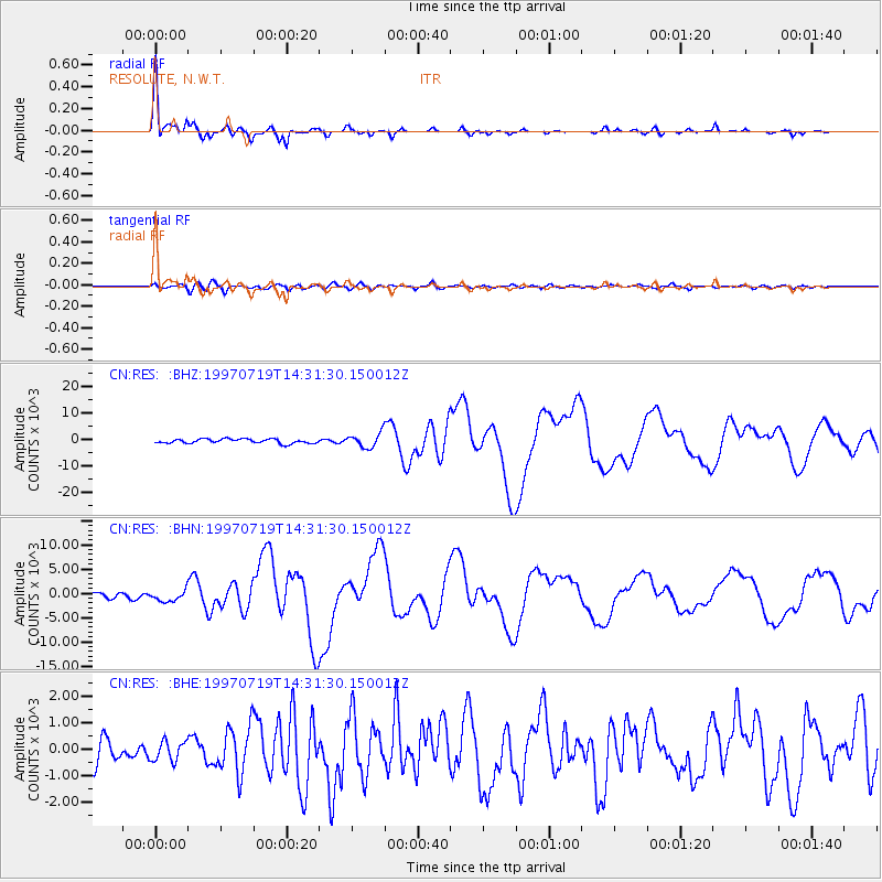
Earthquake location: Near Coast Of Guerrero, Mexico
Earthquake latitude/longitude: 16.3/-98.2
Earthquake time(UTC): 1997/07/19 (200) 14:22:08 GMT
Earthquake Depth: 33 km
Earthquake Magnitude: 5.7 MB, 6.3 MS, 6.8 UNKNOWN, 6.0 ME
Earthquake Catalog/Contributor: WHDF/NEIC
Network: CN Canadian National Seismograph Network
Station: RES RESOLUTE, N.W.T.
Lat/Lon: 74.69 N/94.90 W
Elevation: 15 m
Distance: 58.4 deg
Az: 1.034 deg
Baz: 183.739 deg
Ray Param: 0.06281958
Estimated Moho Depth: 14.25 km
Estimated Crust Vp/Vs: 1.72
Assumed Crust Vp: 6.367 km/s
Estimated Crust Vs: 3.696 km/s
Estimated Crust Poisson's Ratio: 0.25
Radial Match: 97.369865 %
Radial Bump: 350
Transverse Match: 67.57999 %
Transverse Bump: 400
SOD ConfigId: 6273
Insert Time: 2010-02-27 07:01:21.932 +0000
GWidth: 2.5
Max Bumps: 400
Tol: 0.001

Signal To Noise

ChannelStoNSTALTA
CN:RES: :BHN:19970719T14:31:30.150012Z2.35396171159.0948492.40173
CN:RES: :BHE:19970719T14:31:30.150012Z0.7014591373.9256533.0683
CN:RES: :BHZ:19970719T14:31:30.150012Z3.31746942733.0562823.83765
Arrivals
Ps1.7 SECOND
PpPs5.8 SECOND
PsPs/PpSs7.5 SECOND