You are here: Home > Network List > US - United States National Seismic Network Stations List
> Station DGMT Dagmar, Montana, USA > Earthquake Result Viewer
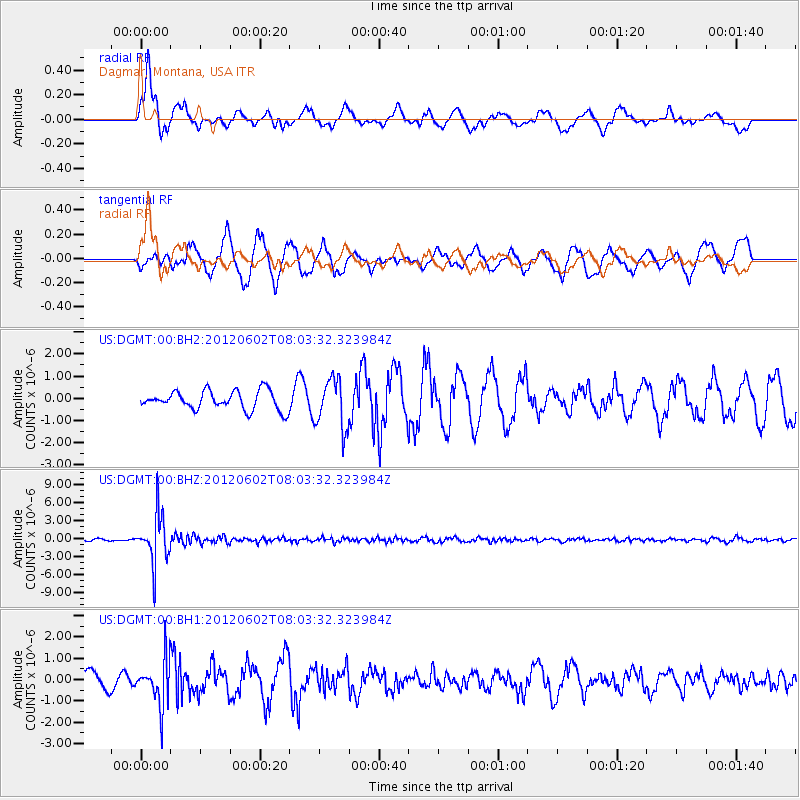
DGMT Dagmar, Montana, USA - Earthquake Result Viewer
*The percent match for this event was below the threshold and hence no stack was calculated.
| Earthquake location: |
Salta Province, Argentina |
| Earthquake latitude/longitude: |
-22.1/-63.6 |
| Earthquake time(UTC): |
2012/06/02 (154) 07:52:53 GMT |
| Earthquake Depth: |
527 km |
| Earthquake Magnitude: |
5.8 MB, 5.9 MW, 6.0 MW |
| Earthquake Catalog/Contributor: |
WHDF/NEIC |
|
| Network: |
US United States National Seismic Network |
| Station: |
DGMT Dagmar, Montana, USA |
| Lat/Lon: |
48.47 N/104.20 W |
| Elevation: |
0.0 m |
|
| Distance: |
79.1 deg |
| Az: |
333.802 deg |
| Baz: |
142.02 deg |
| Ray Param: |
$rayparam |
*The percent match for this event was below the threshold and hence was not used in the summary stack. |
|
| Radial Match: |
54.89939 % |
| Radial Bump: |
400 |
| Transverse Match: |
61.034637 % |
| Transverse Bump: |
400 |
| SOD ConfigId: |
558545 |
| Insert Time: |
2013-09-19 19:45:49.956 +0000 |
| GWidth: |
2.5 |
| Max Bumps: |
400 |
| Tol: |
0.001 |
|
Signal To Noise
| Channel | StoN | STA | LTA |
| US:DGMT:00:BHZ:20120602T08:03:32.323984Z | 21.175148 | 4.0055147E-6 | 1.8916111E-7 |
| US:DGMT:00:BH1:20120602T08:03:32.323984Z | 2.5970483 | 1.0776081E-6 | 4.1493573E-7 |
| US:DGMT:00:BH2:20120602T08:03:32.323984Z | 2.6525557 | 1.1218026E-6 | 4.2291387E-7 |
| Arrivals |
| Ps | |
| PpPs | |
| PsPs/PpSs | |


