You are here: Home > Network List > US - United States National Seismic Network Stations List
> Station HAWA Hanford, Washington, USA > Earthquake Result Viewer
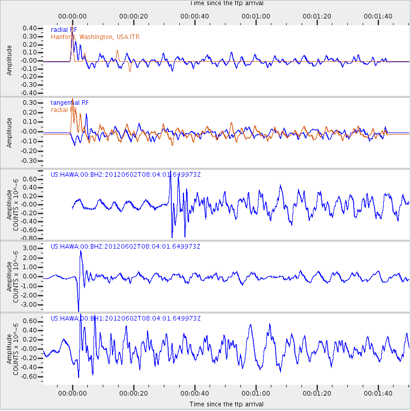
HAWA Hanford, Washington, USA - Earthquake Result Viewer
*The percent match for this event was below the threshold and hence no stack was calculated.
| Earthquake location: |
Salta Province, Argentina |
| Earthquake latitude/longitude: |
-22.1/-63.6 |
| Earthquake time(UTC): |
2012/06/02 (154) 07:52:53 GMT |
| Earthquake Depth: |
527 km |
| Earthquake Magnitude: |
5.8 MB, 5.9 MW, 6.0 MW |
| Earthquake Catalog/Contributor: |
WHDF/NEIC |
|
| Network: |
US United States National Seismic Network |
| Station: |
HAWA Hanford, Washington, USA |
| Lat/Lon: |
46.39 N/119.53 W |
| Elevation: |
364 m |
|
| Distance: |
84.9 deg |
| Az: |
324.831 deg |
| Baz: |
129.467 deg |
| Ray Param: |
$rayparam |
*The percent match for this event was below the threshold and hence was not used in the summary stack. |
|
| Radial Match: |
53.783016 % |
| Radial Bump: |
400 |
| Transverse Match: |
49.753113 % |
| Transverse Bump: |
400 |
| SOD ConfigId: |
558545 |
| Insert Time: |
2013-09-19 19:46:08.265 +0000 |
| GWidth: |
2.5 |
| Max Bumps: |
400 |
| Tol: |
0.001 |
|
Signal To Noise
| Channel | StoN | STA | LTA |
| US:HAWA:00:BHZ:20120602T08:04:01.649973Z | 8.3503475 | 1.3179986E-6 | 1.5783756E-7 |
| US:HAWA:00:BH1:20120602T08:04:01.649973Z | 1.9417708 | 3.299569E-7 | 1.6992577E-7 |
| US:HAWA:00:BH2:20120602T08:04:01.649973Z | 4.4811935 | 3.4742922E-7 | 7.753051E-8 |
| Arrivals |
| Ps | |
| PpPs | |
| PsPs/PpSs | |


