You are here: Home > Network List > US - United States National Seismic Network Stations List
> Station MSO Missoula, Montana, USA > Earthquake Result Viewer
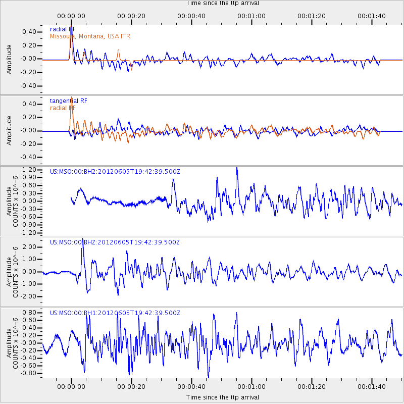
MSO Missoula, Montana, USA - Earthquake Result Viewer
*The percent match for this event was below the threshold and hence no stack was calculated.
| Earthquake location: |
Off East Coast Of Honshu, Japan |
| Earthquake latitude/longitude: |
34.9/141.1 |
| Earthquake time(UTC): |
2012/06/05 (157) 19:31:33 GMT |
| Earthquake Depth: |
15 km |
| Earthquake Magnitude: |
6.2 MB, 6.0 MS, 6.1 MW, 6.1 MW |
| Earthquake Catalog/Contributor: |
WHDF/NEIC |
|
| Network: |
US United States National Seismic Network |
| Station: |
MSO Missoula, Montana, USA |
| Lat/Lon: |
46.83 N/113.94 W |
| Elevation: |
1264 m |
|
| Distance: |
74.4 deg |
| Az: |
43.542 deg |
| Baz: |
304.489 deg |
| Ray Param: |
$rayparam |
*The percent match for this event was below the threshold and hence was not used in the summary stack. |
|
| Radial Match: |
73.503624 % |
| Radial Bump: |
400 |
| Transverse Match: |
51.598877 % |
| Transverse Bump: |
400 |
| SOD ConfigId: |
558545 |
| Insert Time: |
2013-09-19 20:05:05.212 +0000 |
| GWidth: |
2.5 |
| Max Bumps: |
400 |
| Tol: |
0.001 |
|
Signal To Noise
| Channel | StoN | STA | LTA |
| US:MSO:00:BHZ:20120605T19:42:39.500Z | 7.8222895 | 8.732923E-7 | 1.11641526E-7 |
| US:MSO:00:BH1:20120605T19:42:39.500Z | 3.0533712 | 3.2215902E-7 | 1.05509294E-7 |
| US:MSO:00:BH2:20120605T19:42:39.500Z | 2.020244 | 3.0262026E-7 | 1.4979392E-7 |
| Arrivals |
| Ps | |
| PpPs | |
| PsPs/PpSs | |


