You are here: Home > Network List > IU - Global Seismograph Network (GSN - IRIS/USGS) Stations List
> Station POHA Pohakuloa, Hawaii, USA > Earthquake Result Viewer
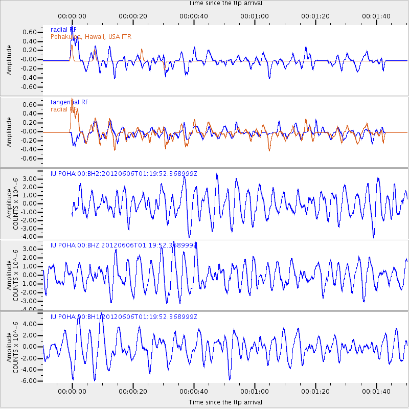
POHA Pohakuloa, Hawaii, USA - Earthquake Result Viewer
*The percent match for this event was below the threshold and hence no stack was calculated.
| Earthquake location: |
Taiwan Region |
| Earthquake latitude/longitude: |
22.4/121.4 |
| Earthquake time(UTC): |
2012/06/06 (158) 01:08:35 GMT |
| Earthquake Depth: |
24 km |
| Earthquake Magnitude: |
5.6 MW, 5.5 MW, 5.6 MB |
| Earthquake Catalog/Contributor: |
NEIC PDE/NEIC PDE-M |
|
| Network: |
IU Global Seismograph Network (GSN - IRIS/USGS) |
| Station: |
POHA Pohakuloa, Hawaii, USA |
| Lat/Lon: |
19.76 N/155.53 W |
| Elevation: |
1990 m |
|
| Distance: |
76.5 deg |
| Az: |
74.01 deg |
| Baz: |
289.117 deg |
| Ray Param: |
$rayparam |
*The percent match for this event was below the threshold and hence was not used in the summary stack. |
|
| Radial Match: |
49.74557 % |
| Radial Bump: |
400 |
| Transverse Match: |
54.180573 % |
| Transverse Bump: |
400 |
| SOD ConfigId: |
558545 |
| Insert Time: |
2013-09-19 20:07:54.417 +0000 |
| GWidth: |
2.5 |
| Max Bumps: |
400 |
| Tol: |
0.001 |
|
Signal To Noise
| Channel | StoN | STA | LTA |
| IU:POHA:00:BHZ:20120606T01:19:52.368999Z | 0.90506345 | 9.863809E-7 | 1.0898473E-6 |
| IU:POHA:00:BH1:20120606T01:19:52.368999Z | 2.2361927 | 3.2992968E-6 | 1.4754082E-6 |
| IU:POHA:00:BH2:20120606T01:19:52.368999Z | 1.3724854 | 1.424992E-6 | 1.0382566E-6 |
| Arrivals |
| Ps | |
| PpPs | |
| PsPs/PpSs | |


