You are here: Home > Network List > US - United States National Seismic Network Stations List
> Station HAWA Hanford, Washington, USA > Earthquake Result Viewer
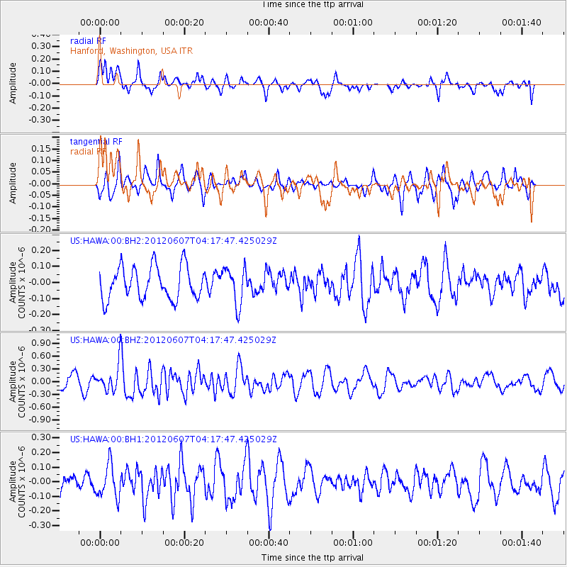
HAWA Hanford, Washington, USA - Earthquake Result Viewer
*The percent match for this event was below the threshold and hence no stack was calculated.
| Earthquake location: |
Chile-Argentina Border Region |
| Earthquake latitude/longitude: |
-36.1/-70.6 |
| Earthquake time(UTC): |
2012/06/07 (159) 04:05:04 GMT |
| Earthquake Depth: |
8.0 km |
| Earthquake Magnitude: |
6.0 MW, 5.7 MS, 5.9 MB, 5.9 MW |
| Earthquake Catalog/Contributor: |
NEIC PDE/NEIC PDE-M |
|
| Network: |
US United States National Seismic Network |
| Station: |
HAWA Hanford, Washington, USA |
| Lat/Lon: |
46.39 N/119.53 W |
| Elevation: |
364 m |
|
| Distance: |
93.2 deg |
| Az: |
328.476 deg |
| Baz: |
142.266 deg |
| Ray Param: |
$rayparam |
*The percent match for this event was below the threshold and hence was not used in the summary stack. |
|
| Radial Match: |
59.89103 % |
| Radial Bump: |
396 |
| Transverse Match: |
63.417164 % |
| Transverse Bump: |
352 |
| SOD ConfigId: |
558545 |
| Insert Time: |
2013-09-19 20:11:15.436 +0000 |
| GWidth: |
2.5 |
| Max Bumps: |
400 |
| Tol: |
0.001 |
|
Signal To Noise
| Channel | StoN | STA | LTA |
| US:HAWA:00:BHZ:20120607T04:17:47.425029Z | 2.186271 | 3.1277577E-7 | 1.4306359E-7 |
| US:HAWA:00:BH1:20120607T04:17:47.425029Z | 1.0462989 | 1.15847726E-7 | 1.1072146E-7 |
| US:HAWA:00:BH2:20120607T04:17:47.425029Z | 1.1763314 | 1.18315334E-7 | 1.0057993E-7 |
| Arrivals |
| Ps | |
| PpPs | |
| PsPs/PpSs | |


