You are here: Home > Network List > US - United States National Seismic Network Stations List
> Station DGMT Dagmar, Montana, USA > Earthquake Result Viewer
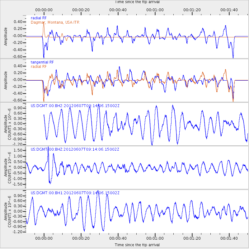
DGMT Dagmar, Montana, USA - Earthquake Result Viewer
*The percent match for this event was below the threshold and hence no stack was calculated.
| Earthquake location: |
Fiji Islands Region |
| Earthquake latitude/longitude: |
-20.2/-176.3 |
| Earthquake time(UTC): |
2012/06/07 (159) 09:01:51 GMT |
| Earthquake Depth: |
266 km |
| Earthquake Magnitude: |
5.8 MW, 5.6 MB, 5.9 MW |
| Earthquake Catalog/Contributor: |
NEIC PDE/NEIC PDE-M |
|
| Network: |
US United States National Seismic Network |
| Station: |
DGMT Dagmar, Montana, USA |
| Lat/Lon: |
48.47 N/104.20 W |
| Elevation: |
0.0 m |
|
| Distance: |
93.7 deg |
| Az: |
39.403 deg |
| Baz: |
243.625 deg |
| Ray Param: |
$rayparam |
*The percent match for this event was below the threshold and hence was not used in the summary stack. |
|
| Radial Match: |
50.818363 % |
| Radial Bump: |
400 |
| Transverse Match: |
40.002483 % |
| Transverse Bump: |
400 |
| SOD ConfigId: |
558545 |
| Insert Time: |
2013-09-19 20:14:23.698 +0000 |
| GWidth: |
2.5 |
| Max Bumps: |
400 |
| Tol: |
0.001 |
|
Signal To Noise
| Channel | StoN | STA | LTA |
| US:DGMT:00:BHZ:20120607T09:14:06.15002Z | 3.4162624 | 8.338272E-7 | 2.4407584E-7 |
| US:DGMT:00:BH1:20120607T09:14:06.15002Z | 0.36060992 | 1.474274E-7 | 4.0882787E-7 |
| US:DGMT:00:BH2:20120607T09:14:06.15002Z | 1.1005273 | 6.536972E-7 | 5.939855E-7 |
| Arrivals |
| Ps | |
| PpPs | |
| PsPs/PpSs | |


