You are here: Home > Network List > US - United States National Seismic Network Stations List
> Station HAWA Hanford, Washington, USA > Earthquake Result Viewer
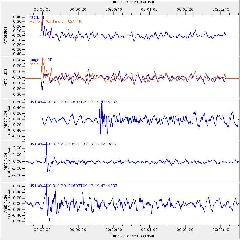
HAWA Hanford, Washington, USA - Earthquake Result Viewer
*The percent match for this event was below the threshold and hence no stack was calculated.
| Earthquake location: |
Fiji Islands Region |
| Earthquake latitude/longitude: |
-20.2/-176.3 |
| Earthquake time(UTC): |
2012/06/07 (159) 09:01:51 GMT |
| Earthquake Depth: |
266 km |
| Earthquake Magnitude: |
5.8 MW, 5.6 MB, 5.9 MW |
| Earthquake Catalog/Contributor: |
NEIC PDE/NEIC PDE-M |
|
| Network: |
US United States National Seismic Network |
| Station: |
HAWA Hanford, Washington, USA |
| Lat/Lon: |
46.39 N/119.53 W |
| Elevation: |
364 m |
|
| Distance: |
83.8 deg |
| Az: |
35.636 deg |
| Baz: |
232.249 deg |
| Ray Param: |
$rayparam |
*The percent match for this event was below the threshold and hence was not used in the summary stack. |
|
| Radial Match: |
60.604057 % |
| Radial Bump: |
400 |
| Transverse Match: |
69.63731 % |
| Transverse Bump: |
400 |
| SOD ConfigId: |
558545 |
| Insert Time: |
2013-09-19 20:14:34.407 +0000 |
| GWidth: |
2.5 |
| Max Bumps: |
400 |
| Tol: |
0.001 |
|
Signal To Noise
| Channel | StoN | STA | LTA |
| US:HAWA:00:BHZ:20120607T09:13:19.424983Z | 6.511368 | 9.333213E-7 | 1.4333722E-7 |
| US:HAWA:00:BH1:20120607T09:13:19.424983Z | 4.591106 | 3.1936202E-7 | 6.956102E-8 |
| US:HAWA:00:BH2:20120607T09:13:19.424983Z | 2.840606 | 2.6404106E-7 | 9.295238E-8 |
| Arrivals |
| Ps | |
| PpPs | |
| PsPs/PpSs | |


