You are here: Home > Network List > US - United States National Seismic Network Stations List
> Station DGMT Dagmar, Montana, USA > Earthquake Result Viewer
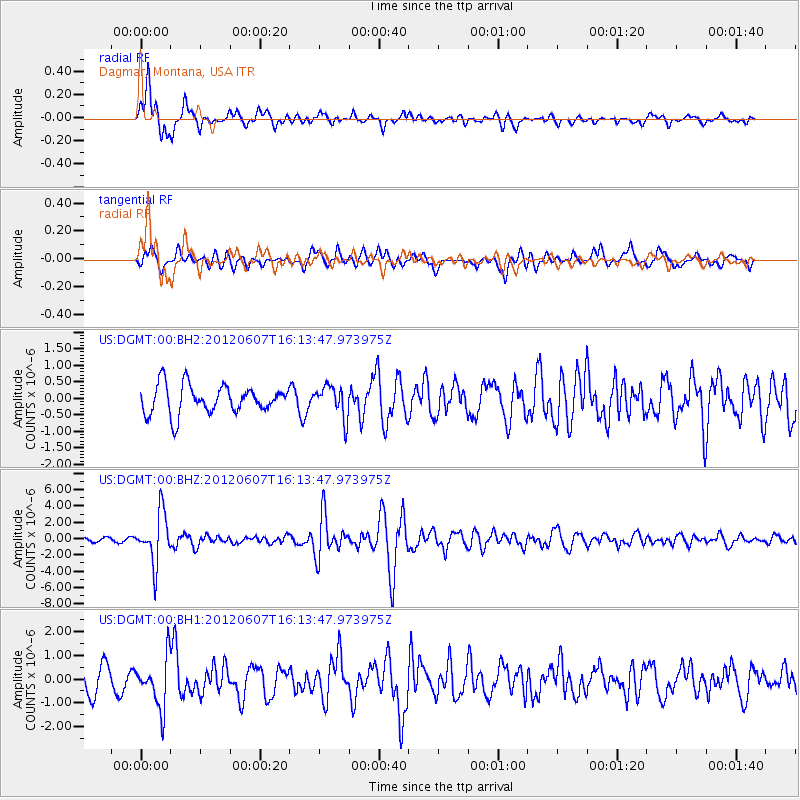
DGMT Dagmar, Montana, USA - Earthquake Result Viewer
*The percent match for this event was below the threshold and hence no stack was calculated.
| Earthquake location: |
Southern Peru |
| Earthquake latitude/longitude: |
-15.9/-72.4 |
| Earthquake time(UTC): |
2012/06/07 (159) 16:03:18 GMT |
| Earthquake Depth: |
110 km |
| Earthquake Magnitude: |
6.1 MW, 6.1 MB, 6.1 MW |
| Earthquake Catalog/Contributor: |
NEIC PDE/NEIC PDE-M |
|
| Network: |
US United States National Seismic Network |
| Station: |
DGMT Dagmar, Montana, USA |
| Lat/Lon: |
48.47 N/104.20 W |
| Elevation: |
0.0 m |
|
| Distance: |
70.0 deg |
| Az: |
338.103 deg |
| Baz: |
147.366 deg |
| Ray Param: |
$rayparam |
*The percent match for this event was below the threshold and hence was not used in the summary stack. |
|
| Radial Match: |
80.66748 % |
| Radial Bump: |
400 |
| Transverse Match: |
64.63691 % |
| Transverse Bump: |
400 |
| SOD ConfigId: |
558545 |
| Insert Time: |
2013-09-19 20:17:32.314 +0000 |
| GWidth: |
2.5 |
| Max Bumps: |
400 |
| Tol: |
0.001 |
|
Signal To Noise
| Channel | StoN | STA | LTA |
| US:DGMT:00:BHZ:20120607T16:13:47.973975Z | 13.366239 | 3.0627614E-6 | 2.291416E-7 |
| US:DGMT:00:BH1:20120607T16:13:47.973975Z | 1.7500758 | 1.0573531E-6 | 6.041756E-7 |
| US:DGMT:00:BH2:20120607T16:13:47.973975Z | 1.109462 | 4.7758147E-7 | 4.3046217E-7 |
| Arrivals |
| Ps | |
| PpPs | |
| PsPs/PpSs | |


