You are here: Home > Network List > US - United States National Seismic Network Stations List
> Station DGMT Dagmar, Montana, USA > Earthquake Result Viewer
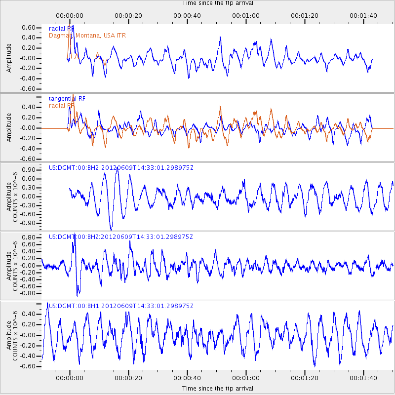
DGMT Dagmar, Montana, USA - Earthquake Result Viewer
*The percent match for this event was below the threshold and hence no stack was calculated.
| Earthquake location: |
Kuril Islands |
| Earthquake latitude/longitude: |
48.9/154.9 |
| Earthquake time(UTC): |
2012/06/09 (161) 14:23:20 GMT |
| Earthquake Depth: |
49 km |
| Earthquake Magnitude: |
5.5 MW |
| Earthquake Catalog/Contributor: |
NEIC PDE/NEIC PDE-M |
|
| Network: |
US United States National Seismic Network |
| Station: |
DGMT Dagmar, Montana, USA |
| Lat/Lon: |
48.47 N/104.20 W |
| Elevation: |
0.0 m |
|
| Distance: |
61.5 deg |
| Az: |
48.017 deg |
| Baz: |
312.457 deg |
| Ray Param: |
$rayparam |
*The percent match for this event was below the threshold and hence was not used in the summary stack. |
|
| Radial Match: |
42.806976 % |
| Radial Bump: |
400 |
| Transverse Match: |
44.184547 % |
| Transverse Bump: |
400 |
| SOD ConfigId: |
558545 |
| Insert Time: |
2013-09-19 20:22:09.996 +0000 |
| GWidth: |
2.5 |
| Max Bumps: |
400 |
| Tol: |
0.001 |
|
Signal To Noise
| Channel | StoN | STA | LTA |
| US:DGMT:00:BHZ:20120609T14:33:01.298975Z | 4.158424 | 4.6408866E-7 | 1.11602056E-7 |
| US:DGMT:00:BH1:20120609T14:33:01.298975Z | 0.677225 | 2.21233E-7 | 3.2667575E-7 |
| US:DGMT:00:BH2:20120609T14:33:01.298975Z | 0.4765984 | 2.1518176E-7 | 4.514949E-7 |
| Arrivals |
| Ps | |
| PpPs | |
| PsPs/PpSs | |


