You are here: Home > Network List > US - United States National Seismic Network Stations List
> Station EGMT Eagleton, Montana, USA > Earthquake Result Viewer
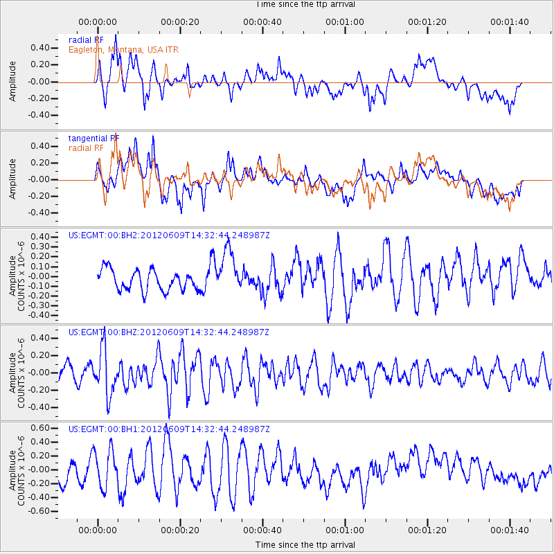
EGMT Eagleton, Montana, USA - Earthquake Result Viewer
*The percent match for this event was below the threshold and hence no stack was calculated.
| Earthquake location: |
Kuril Islands |
| Earthquake latitude/longitude: |
48.9/154.9 |
| Earthquake time(UTC): |
2012/06/09 (161) 14:23:20 GMT |
| Earthquake Depth: |
49 km |
| Earthquake Magnitude: |
5.5 MW |
| Earthquake Catalog/Contributor: |
NEIC PDE/NEIC PDE-M |
|
| Network: |
US United States National Seismic Network |
| Station: |
EGMT Eagleton, Montana, USA |
| Lat/Lon: |
48.02 N/109.75 W |
| Elevation: |
1055 m |
|
| Distance: |
59.0 deg |
| Az: |
51.221 deg |
| Baz: |
309.91 deg |
| Ray Param: |
$rayparam |
*The percent match for this event was below the threshold and hence was not used in the summary stack. |
|
| Radial Match: |
63.20651 % |
| Radial Bump: |
400 |
| Transverse Match: |
61.944435 % |
| Transverse Bump: |
400 |
| SOD ConfigId: |
558545 |
| Insert Time: |
2013-09-19 20:22:22.046 +0000 |
| GWidth: |
2.5 |
| Max Bumps: |
400 |
| Tol: |
0.001 |
|
Signal To Noise
| Channel | StoN | STA | LTA |
| US:EGMT:00:BHZ:20120609T14:32:44.248987Z | 2.769747 | 2.6480362E-7 | 9.5605714E-8 |
| US:EGMT:00:BH1:20120609T14:32:44.248987Z | 1.454889 | 2.626864E-7 | 1.8055425E-7 |
| US:EGMT:00:BH2:20120609T14:32:44.248987Z | 2.263284 | 2.3115423E-7 | 1.02132226E-7 |
| Arrivals |
| Ps | |
| PpPs | |
| PsPs/PpSs | |


