You are here: Home > Network List > US - United States National Seismic Network Stations List
> Station MIAR Mount Ida, Arkansas, USA > Earthquake Result Viewer
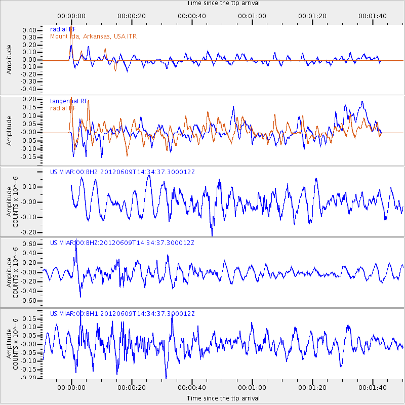
MIAR Mount Ida, Arkansas, USA - Earthquake Result Viewer
*The percent match for this event was below the threshold and hence no stack was calculated.
| Earthquake location: |
Kuril Islands |
| Earthquake latitude/longitude: |
48.9/154.9 |
| Earthquake time(UTC): |
2012/06/09 (161) 14:23:20 GMT |
| Earthquake Depth: |
49 km |
| Earthquake Magnitude: |
5.5 MW |
| Earthquake Catalog/Contributor: |
NEIC PDE/NEIC PDE-M |
|
| Network: |
US United States National Seismic Network |
| Station: |
MIAR Mount Ida, Arkansas, USA |
| Lat/Lon: |
34.55 N/93.58 W |
| Elevation: |
207 m |
|
| Distance: |
77.1 deg |
| Az: |
51.955 deg |
| Baz: |
320.937 deg |
| Ray Param: |
$rayparam |
*The percent match for this event was below the threshold and hence was not used in the summary stack. |
|
| Radial Match: |
52.171516 % |
| Radial Bump: |
400 |
| Transverse Match: |
45.312855 % |
| Transverse Bump: |
400 |
| SOD ConfigId: |
558545 |
| Insert Time: |
2013-09-19 20:23:03.655 +0000 |
| GWidth: |
2.5 |
| Max Bumps: |
400 |
| Tol: |
0.001 |
|
Signal To Noise
| Channel | StoN | STA | LTA |
| US:MIAR:00:BHZ:20120609T14:34:37.300012Z | 2.5490112 | 2.561318E-7 | 1.0048281E-7 |
| US:MIAR:00:BH1:20120609T14:34:37.300012Z | 1.0864679 | 8.1088444E-8 | 7.463492E-8 |
| US:MIAR:00:BH2:20120609T14:34:37.300012Z | 1.1306236 | 8.230346E-8 | 7.279474E-8 |
| Arrivals |
| Ps | |
| PpPs | |
| PsPs/PpSs | |


