You are here: Home > Network List > II - Global Seismograph Network (GSN - IRIS/IDA) Stations List
> Station WRAB Tennant Creek, NT, Australia > Earthquake Result Viewer
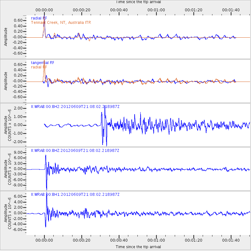
WRAB Tennant Creek, NT, Australia - Earthquake Result Viewer
*The percent match for this event was below the threshold and hence no stack was calculated.
| Earthquake location: |
Taiwan Region |
| Earthquake latitude/longitude: |
24.6/122.2 |
| Earthquake time(UTC): |
2012/06/09 (161) 21:00:18 GMT |
| Earthquake Depth: |
70 km |
| Earthquake Magnitude: |
5.9 MW, 5.9 MW, 6.0 MB |
| Earthquake Catalog/Contributor: |
NEIC PDE/NEIC PDE-M |
|
| Network: |
II Global Seismograph Network (GSN - IRIS/IDA) |
| Station: |
WRAB Tennant Creek, NT, Australia |
| Lat/Lon: |
19.93 S/134.36 E |
| Elevation: |
366 m |
|
| Distance: |
45.8 deg |
| Az: |
164.012 deg |
| Baz: |
344.54 deg |
| Ray Param: |
$rayparam |
*The percent match for this event was below the threshold and hence was not used in the summary stack. |
|
| Radial Match: |
75.93292 % |
| Radial Bump: |
357 |
| Transverse Match: |
76.90426 % |
| Transverse Bump: |
400 |
| SOD ConfigId: |
558545 |
| Insert Time: |
2013-09-19 20:24:54.345 +0000 |
| GWidth: |
2.5 |
| Max Bumps: |
400 |
| Tol: |
0.001 |
|
Signal To Noise
| Channel | StoN | STA | LTA |
| II:WRAB:00:BHZ:20120609T21:08:02.218987Z | 17.553736 | 3.4512316E-6 | 1.9660952E-7 |
| II:WRAB:00:BH1:20120609T21:08:02.218987Z | 12.004966 | 2.166186E-6 | 1.8044085E-7 |
| II:WRAB:00:BH2:20120609T21:08:02.218987Z | 11.793281 | 1.0782327E-6 | 9.1427715E-8 |
| Arrivals |
| Ps | |
| PpPs | |
| PsPs/PpSs | |


