You are here: Home > Network List > IU - Global Seismograph Network (GSN - IRIS/USGS) Stations List
> Station POHA Pohakuloa, Hawaii, USA > Earthquake Result Viewer
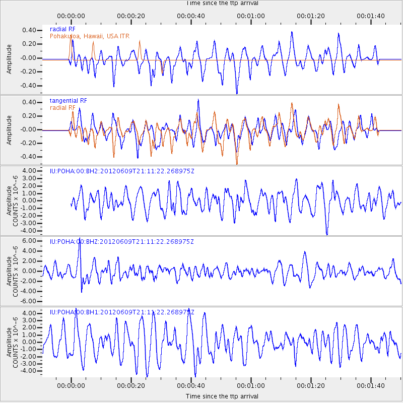
POHA Pohakuloa, Hawaii, USA - Earthquake Result Viewer
*The percent match for this event was below the threshold and hence no stack was calculated.
| Earthquake location: |
Taiwan Region |
| Earthquake latitude/longitude: |
24.6/122.2 |
| Earthquake time(UTC): |
2012/06/09 (161) 21:00:18 GMT |
| Earthquake Depth: |
70 km |
| Earthquake Magnitude: |
5.9 MW, 5.9 MW, 6.0 MB |
| Earthquake Catalog/Contributor: |
NEIC PDE/NEIC PDE-M |
|
| Network: |
IU Global Seismograph Network (GSN - IRIS/USGS) |
| Station: |
POHA Pohakuloa, Hawaii, USA |
| Lat/Lon: |
19.76 N/155.53 W |
| Elevation: |
1990 m |
|
| Distance: |
75.2 deg |
| Az: |
74.818 deg |
| Baz: |
291.098 deg |
| Ray Param: |
$rayparam |
*The percent match for this event was below the threshold and hence was not used in the summary stack. |
|
| Radial Match: |
61.406067 % |
| Radial Bump: |
400 |
| Transverse Match: |
53.08271 % |
| Transverse Bump: |
400 |
| SOD ConfigId: |
558545 |
| Insert Time: |
2013-09-19 20:25:39.396 +0000 |
| GWidth: |
2.5 |
| Max Bumps: |
400 |
| Tol: |
0.001 |
|
Signal To Noise
| Channel | StoN | STA | LTA |
| IU:POHA:00:BHZ:20120609T21:11:22.268975Z | 2.0381818 | 2.5406619E-6 | 1.2465334E-6 |
| IU:POHA:00:BH1:20120609T21:11:22.268975Z | 1.771875 | 2.4094456E-6 | 1.3598282E-6 |
| IU:POHA:00:BH2:20120609T21:11:22.268975Z | 1.2882017 | 1.4794481E-6 | 1.14846E-6 |
| Arrivals |
| Ps | |
| PpPs | |
| PsPs/PpSs | |


