You are here: Home > Network List > US - United States National Seismic Network Stations List
> Station HAWA Hanford, Washington, USA > Earthquake Result Viewer
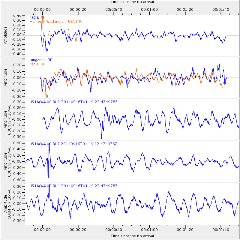
HAWA Hanford, Washington, USA - Earthquake Result Viewer
*The percent match for this event was below the threshold and hence no stack was calculated.
| Earthquake location: |
Fiji Islands Region |
| Earthquake latitude/longitude: |
-21.0/-178.9 |
| Earthquake time(UTC): |
2014/09/16 (259) 01:08:18 GMT |
| Earthquake Depth: |
618 km |
| Earthquake Magnitude: |
5.3 MW |
| Earthquake Catalog/Contributor: |
ISC/ISC |
|
| Network: |
US United States National Seismic Network |
| Station: |
HAWA Hanford, Washington, USA |
| Lat/Lon: |
46.39 N/119.53 W |
| Elevation: |
364 m |
|
| Distance: |
85.8 deg |
| Az: |
36.656 deg |
| Baz: |
233.703 deg |
| Ray Param: |
$rayparam |
*The percent match for this event was below the threshold and hence was not used in the summary stack. |
|
| Radial Match: |
52.0639 % |
| Radial Bump: |
400 |
| Transverse Match: |
51.826027 % |
| Transverse Bump: |
400 |
| SOD ConfigId: |
3390531 |
| Insert Time: |
2019-04-14 01:50:57.607 +0000 |
| GWidth: |
2.5 |
| Max Bumps: |
400 |
| Tol: |
0.001 |
|
Signal To Noise
| Channel | StoN | STA | LTA |
| US:HAWA:00:BHZ:20140916T01:19:22.474978Z | 2.712756 | 2.2136891E-7 | 8.1602956E-8 |
| US:HAWA:00:BH1:20140916T01:19:22.474978Z | 2.2115948 | 1.4996296E-7 | 6.7807605E-8 |
| US:HAWA:00:BH2:20140916T01:19:22.474978Z | 1.2083019 | 1.1732358E-7 | 9.70979E-8 |
| Arrivals |
| Ps | |
| PpPs | |
| PsPs/PpSs | |


