You are here: Home > Network List > IU - Global Seismograph Network (GSN - IRIS/USGS) Stations List
> Station PMG Port Moresby, New Guinea > Earthquake Result Viewer
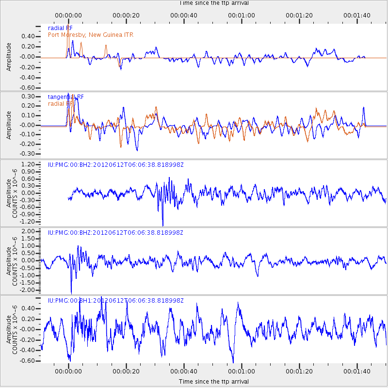
PMG Port Moresby, New Guinea - Earthquake Result Viewer
*The percent match for this event was below the threshold and hence no stack was calculated.
| Earthquake location: |
Sunda Strait, Indonesia |
| Earthquake latitude/longitude: |
-5.7/105.5 |
| Earthquake time(UTC): |
2012/06/12 (164) 05:59:38 GMT |
| Earthquake Depth: |
164 km |
| Earthquake Magnitude: |
5.5 MB |
| Earthquake Catalog/Contributor: |
NEIC PDE/NEIC PDE-M |
|
| Network: |
IU Global Seismograph Network (GSN - IRIS/USGS) |
| Station: |
PMG Port Moresby, New Guinea |
| Lat/Lon: |
9.40 S/147.16 E |
| Elevation: |
90 m |
|
| Distance: |
41.5 deg |
| Az: |
97.737 deg |
| Baz: |
272.054 deg |
| Ray Param: |
$rayparam |
*The percent match for this event was below the threshold and hence was not used in the summary stack. |
|
| Radial Match: |
56.63898 % |
| Radial Bump: |
400 |
| Transverse Match: |
54.70912 % |
| Transverse Bump: |
400 |
| SOD ConfigId: |
558545 |
| Insert Time: |
2013-09-19 20:32:19.516 +0000 |
| GWidth: |
2.5 |
| Max Bumps: |
400 |
| Tol: |
0.001 |
|
Signal To Noise
| Channel | StoN | STA | LTA |
| IU:PMG:00:BHZ:20120612T06:06:38.818998Z | 3.2321575 | 6.420105E-7 | 1.9863218E-7 |
| IU:PMG:00:BH1:20120612T06:06:38.818998Z | 1.7258655 | 3.1750326E-7 | 1.8396756E-7 |
| IU:PMG:00:BH2:20120612T06:06:38.818998Z | 3.2846053 | 3.9489674E-7 | 1.2022655E-7 |
| Arrivals |
| Ps | |
| PpPs | |
| PsPs/PpSs | |


