You are here: Home > Network List > II - Global Seismograph Network (GSN - IRIS/IDA) Stations List
> Station WRAB Tennant Creek, NT, Australia > Earthquake Result Viewer
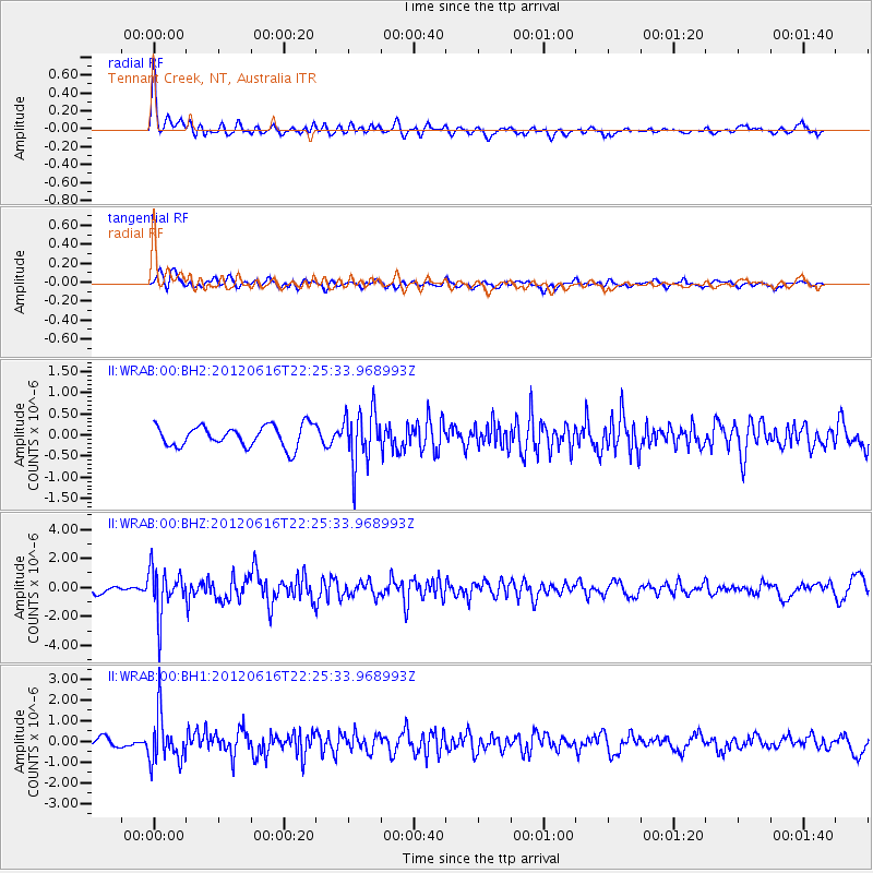
WRAB Tennant Creek, NT, Australia - Earthquake Result Viewer
*The percent match for this event was below the threshold and hence no stack was calculated.
| Earthquake location: |
Luzon, Philippines |
| Earthquake latitude/longitude: |
15.6/119.6 |
| Earthquake time(UTC): |
2012/06/16 (168) 22:18:47 GMT |
| Earthquake Depth: |
28 km |
| Earthquake Magnitude: |
5.9 MW, 5.7 MS, 5.9 MW, 6.1 MB |
| Earthquake Catalog/Contributor: |
NEIC PDE/NEIC PDE-M |
|
| Network: |
II Global Seismograph Network (GSN - IRIS/IDA) |
| Station: |
WRAB Tennant Creek, NT, Australia |
| Lat/Lon: |
19.93 S/134.36 E |
| Elevation: |
366 m |
|
| Distance: |
38.2 deg |
| Az: |
157.127 deg |
| Baz: |
336.539 deg |
| Ray Param: |
$rayparam |
*The percent match for this event was below the threshold and hence was not used in the summary stack. |
|
| Radial Match: |
72.79971 % |
| Radial Bump: |
400 |
| Transverse Match: |
67.01993 % |
| Transverse Bump: |
400 |
| SOD ConfigId: |
558545 |
| Insert Time: |
2013-09-19 20:41:12.013 +0000 |
| GWidth: |
2.5 |
| Max Bumps: |
400 |
| Tol: |
0.001 |
|
Signal To Noise
| Channel | StoN | STA | LTA |
| II:WRAB:00:BHZ:20120616T22:25:33.968993Z | 6.8175735 | 1.569229E-6 | 2.3017411E-7 |
| II:WRAB:00:BH1:20120616T22:25:33.968993Z | 5.910173 | 1.1300425E-6 | 1.9120294E-7 |
| II:WRAB:00:BH2:20120616T22:25:33.968993Z | 2.5357375 | 6.3952484E-7 | 2.5220464E-7 |
| Arrivals |
| Ps | |
| PpPs | |
| PsPs/PpSs | |


