You are here: Home > Network List > II - Global Seismograph Network (GSN - IRIS/IDA) Stations List
> Station PFO Pinon Flat, California, USA > Earthquake Result Viewer
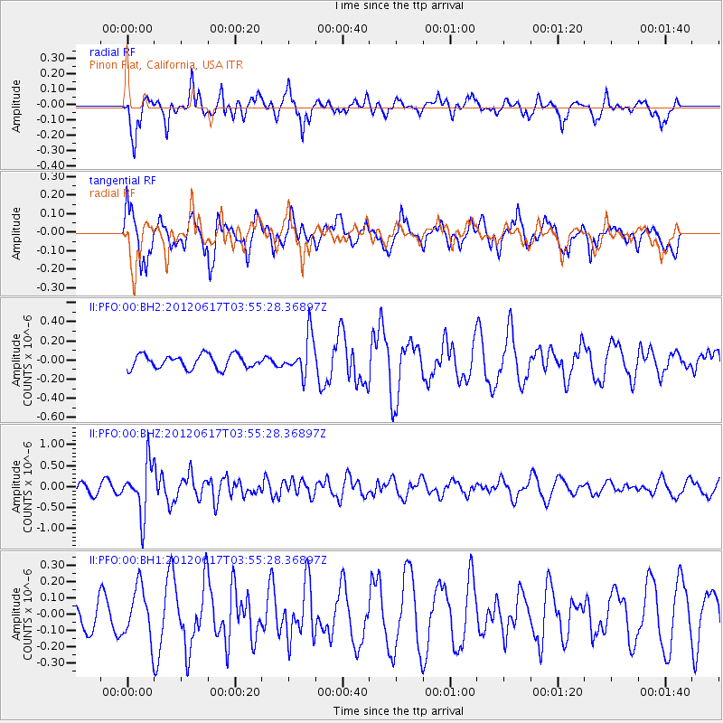
PFO Pinon Flat, California, USA - Earthquake Result Viewer
*The percent match for this event was below the threshold and hence no stack was calculated.
| Earthquake location: |
Solomon Islands |
| Earthquake latitude/longitude: |
-8.5/160.4 |
| Earthquake time(UTC): |
2012/06/17 (169) 03:43:10 GMT |
| Earthquake Depth: |
51 km |
| Earthquake Magnitude: |
5.7 MW, 5.6 MW, 6.0 MB |
| Earthquake Catalog/Contributor: |
NEIC PDE/NEIC PDE-M |
|
| Network: |
II Global Seismograph Network (GSN - IRIS/IDA) |
| Station: |
PFO Pinon Flat, California, USA |
| Lat/Lon: |
33.61 N/116.46 W |
| Elevation: |
1280 m |
|
| Distance: |
89.0 deg |
| Az: |
55.971 deg |
| Baz: |
259.201 deg |
| Ray Param: |
$rayparam |
*The percent match for this event was below the threshold and hence was not used in the summary stack. |
|
| Radial Match: |
67.2517 % |
| Radial Bump: |
400 |
| Transverse Match: |
75.78952 % |
| Transverse Bump: |
400 |
| SOD ConfigId: |
558545 |
| Insert Time: |
2013-09-19 20:43:17.785 +0000 |
| GWidth: |
2.5 |
| Max Bumps: |
400 |
| Tol: |
0.001 |
|
Signal To Noise
| Channel | StoN | STA | LTA |
| II:PFO:00:BHZ:20120617T03:55:28.36897Z | 4.9709873 | 6.153509E-7 | 1.2378847E-7 |
| II:PFO:00:BH1:20120617T03:55:28.36897Z | 0.9719587 | 1.6257162E-7 | 1.6726187E-7 |
| II:PFO:00:BH2:20120617T03:55:28.36897Z | 2.9265645 | 2.069132E-7 | 7.070174E-8 |
| Arrivals |
| Ps | |
| PpPs | |
| PsPs/PpSs | |


