You are here: Home > Network List > IU - Global Seismograph Network (GSN - IRIS/USGS) Stations List
> Station MAJO Matsushiro, Japan > Earthquake Result Viewer
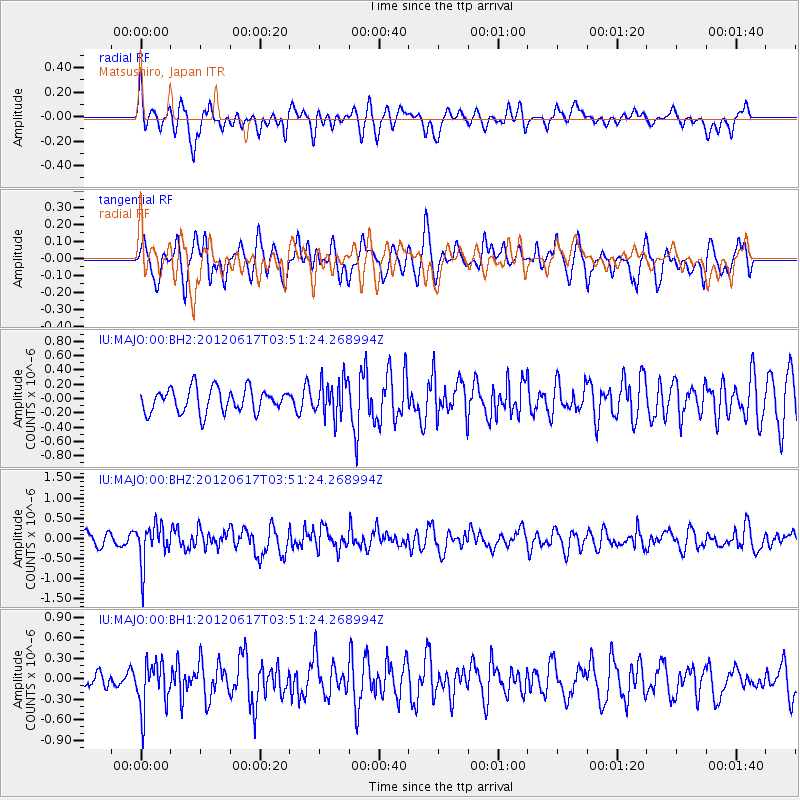
MAJO Matsushiro, Japan - Earthquake Result Viewer
*The percent match for this event was below the threshold and hence no stack was calculated.
| Earthquake location: |
Solomon Islands |
| Earthquake latitude/longitude: |
-8.5/160.4 |
| Earthquake time(UTC): |
2012/06/17 (169) 03:43:10 GMT |
| Earthquake Depth: |
51 km |
| Earthquake Magnitude: |
5.7 MW, 5.6 MW, 6.0 MB |
| Earthquake Catalog/Contributor: |
NEIC PDE/NEIC PDE-M |
|
| Network: |
IU Global Seismograph Network (GSN - IRIS/USGS) |
| Station: |
MAJO Matsushiro, Japan |
| Lat/Lon: |
36.55 N/138.20 E |
| Elevation: |
405 m |
|
| Distance: |
49.4 deg |
| Az: |
336.433 deg |
| Baz: |
150.587 deg |
| Ray Param: |
$rayparam |
*The percent match for this event was below the threshold and hence was not used in the summary stack. |
|
| Radial Match: |
57.33867 % |
| Radial Bump: |
400 |
| Transverse Match: |
58.870228 % |
| Transverse Bump: |
400 |
| SOD ConfigId: |
558545 |
| Insert Time: |
2013-09-19 20:43:41.483 +0000 |
| GWidth: |
2.5 |
| Max Bumps: |
400 |
| Tol: |
0.001 |
|
Signal To Noise
| Channel | StoN | STA | LTA |
| IU:MAJO:00:BHZ:20120617T03:51:24.268994Z | 2.4283717 | 4.9546816E-7 | 2.0403309E-7 |
| IU:MAJO:00:BH1:20120617T03:51:24.268994Z | 1.7170913 | 3.603433E-7 | 2.0985681E-7 |
| IU:MAJO:00:BH2:20120617T03:51:24.268994Z | 1.5343074 | 2.5458E-7 | 1.6592503E-7 |
| Arrivals |
| Ps | |
| PpPs | |
| PsPs/PpSs | |


