You are here: Home > Network List > TA - USArray Transportable Network (new EarthScope stations) Stations List
> Station J04D Umpqua National Forest, Toketee, OR, USA > Earthquake Result Viewer
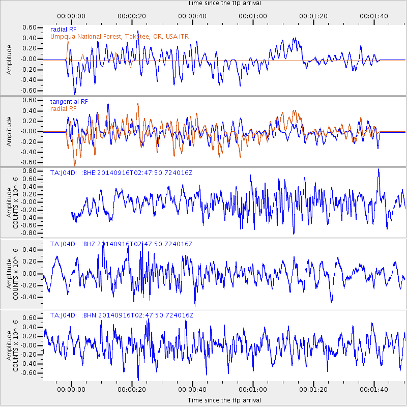
J04D Umpqua National Forest, Toketee, OR, USA - Earthquake Result Viewer
*The percent match for this event was below the threshold and hence no stack was calculated.
| Earthquake location: |
New Britain Region, P.N.G. |
| Earthquake latitude/longitude: |
-6.3/151.7 |
| Earthquake time(UTC): |
2014/09/16 (259) 02:35:19 GMT |
| Earthquake Depth: |
25 km |
| Earthquake Magnitude: |
5.6 MB |
| Earthquake Catalog/Contributor: |
NEIC PDE/NEIC COMCAT |
|
| Network: |
TA USArray Transportable Network (new EarthScope stations) |
| Station: |
J04D Umpqua National Forest, Toketee, OR, USA |
| Lat/Lon: |
43.24 N/122.11 W |
| Elevation: |
1948 m |
|
| Distance: |
91.5 deg |
| Az: |
46.836 deg |
| Baz: |
262.858 deg |
| Ray Param: |
$rayparam |
*The percent match for this event was below the threshold and hence was not used in the summary stack. |
|
| Radial Match: |
57.831963 % |
| Radial Bump: |
400 |
| Transverse Match: |
44.790997 % |
| Transverse Bump: |
400 |
| SOD ConfigId: |
3390531 |
| Insert Time: |
2019-04-14 01:55:45.522 +0000 |
| GWidth: |
2.5 |
| Max Bumps: |
400 |
| Tol: |
0.001 |
|
Signal To Noise
| Channel | StoN | STA | LTA |
| TA:J04D: :BHZ:20140916T02:47:50.724016Z | 1.1350433 | 1.4473687E-7 | 1.2751661E-7 |
| TA:J04D: :BHN:20140916T02:47:50.724016Z | 0.8716189 | 2.0509557E-7 | 2.3530417E-7 |
| TA:J04D: :BHE:20140916T02:47:50.724016Z | 0.99568284 | 2.1354913E-7 | 2.1447505E-7 |
| Arrivals |
| Ps | |
| PpPs | |
| PsPs/PpSs | |


