
EYMN Ely, Minnesota, USA - Earthquake Result Viewer
| ||||||||||||||||||
| ||||||||||||||||||
| ||||||||||||||||||
|
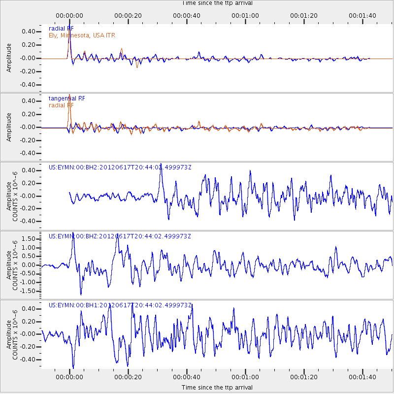
Signal To Noise
| Channel | StoN | STA | LTA |
| US:EYMN:00:BHZ:20120617T20:44:02.499973Z | 13.963177 | 8.6432425E-7 | 6.190026E-8 |
| US:EYMN:00:BH1:20120617T20:44:02.499973Z | 5.447643 | 2.2485506E-7 | 4.1275662E-8 |
| US:EYMN:00:BH2:20120617T20:44:02.499973Z | 5.356755 | 2.1778773E-7 | 4.0656655E-8 |
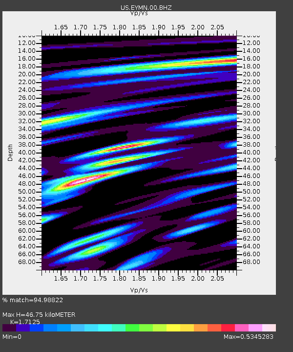
| Arrivals | |
| Ps | 5.3 SECOND |
| PpPs | 19 SECOND |
| PsPs/PpSs | 24 SECOND |

