You are here: Home > Network List > US - United States National Seismic Network Stations List
> Station DGMT Dagmar, Montana, USA > Earthquake Result Viewer
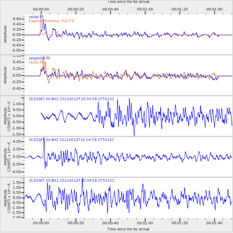
DGMT Dagmar, Montana, USA - Earthquake Result Viewer
*The percent match for this event was below the threshold and hence no stack was calculated.
| Earthquake location: |
Near Islands, Aleutian Islands |
| Earthquake latitude/longitude: |
53.4/171.6 |
| Earthquake time(UTC): |
2012/06/19 (171) 15:56:32 GMT |
| Earthquake Depth: |
14 km |
| Earthquake Magnitude: |
6.2 MB, 5.7 MS, 6.0 MW, 6.1 MW |
| Earthquake Catalog/Contributor: |
WHDF/NEIC |
|
| Network: |
US United States National Seismic Network |
| Station: |
DGMT Dagmar, Montana, USA |
| Lat/Lon: |
48.47 N/104.20 W |
| Elevation: |
0.0 m |
|
| Distance: |
50.4 deg |
| Az: |
59.275 deg |
| Baz: |
309.252 deg |
| Ray Param: |
$rayparam |
*The percent match for this event was below the threshold and hence was not used in the summary stack. |
|
| Radial Match: |
81.65517 % |
| Radial Bump: |
400 |
| Transverse Match: |
65.55789 % |
| Transverse Bump: |
400 |
| SOD ConfigId: |
558545 |
| Insert Time: |
2013-09-19 20:53:19.828 +0000 |
| GWidth: |
2.5 |
| Max Bumps: |
400 |
| Tol: |
0.001 |
|
Signal To Noise
| Channel | StoN | STA | LTA |
| US:DGMT:00:BHZ:20120619T16:04:58.075013Z | 15.233869 | 1.6953603E-6 | 1.11288884E-7 |
| US:DGMT:00:BH1:20120619T16:04:58.075013Z | 3.9266663 | 6.6367556E-7 | 1.6901757E-7 |
| US:DGMT:00:BH2:20120619T16:04:58.075013Z | 1.8848972 | 3.8593774E-7 | 2.0475268E-7 |
| Arrivals |
| Ps | |
| PpPs | |
| PsPs/PpSs | |


