You are here: Home > Network List > II - Global Seismograph Network (GSN - IRIS/IDA) Stations List
> Station WRAB Tennant Creek, NT, Australia > Earthquake Result Viewer
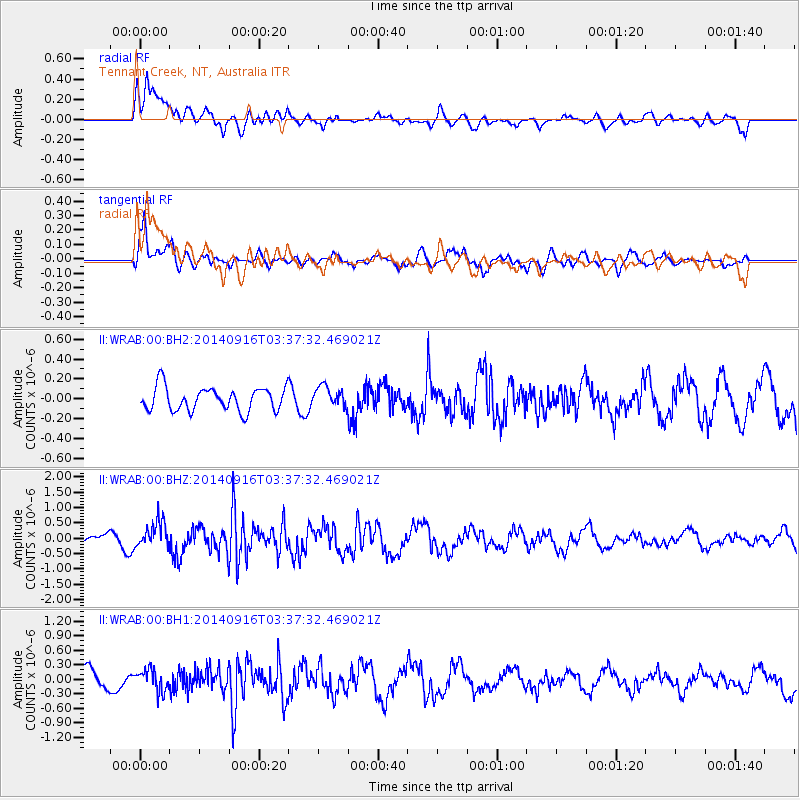
WRAB Tennant Creek, NT, Australia - Earthquake Result Viewer
*The percent match for this event was below the threshold and hence no stack was calculated.
| Earthquake location: |
Eastern Honshu, Japan |
| Earthquake latitude/longitude: |
36.1/139.9 |
| Earthquake time(UTC): |
2014/09/16 (259) 03:28:31 GMT |
| Earthquake Depth: |
54 km |
| Earthquake Magnitude: |
5.6 MB |
| Earthquake Catalog/Contributor: |
NEIC PDE/NEIC COMCAT |
|
| Network: |
II Global Seismograph Network (GSN - IRIS/IDA) |
| Station: |
WRAB Tennant Creek, NT, Australia |
| Lat/Lon: |
19.93 S/134.36 E |
| Elevation: |
366 m |
|
| Distance: |
55.9 deg |
| Az: |
186.266 deg |
| Baz: |
5.393 deg |
| Ray Param: |
$rayparam |
*The percent match for this event was below the threshold and hence was not used in the summary stack. |
|
| Radial Match: |
68.53799 % |
| Radial Bump: |
400 |
| Transverse Match: |
62.694653 % |
| Transverse Bump: |
400 |
| SOD ConfigId: |
3390531 |
| Insert Time: |
2019-04-14 02:00:23.988 +0000 |
| GWidth: |
2.5 |
| Max Bumps: |
400 |
| Tol: |
0.001 |
|
Signal To Noise
| Channel | StoN | STA | LTA |
| II:WRAB:00:BHZ:20140916T03:37:32.469021Z | 1.6036025 | 4.192569E-7 | 2.614469E-7 |
| II:WRAB:00:BH1:20140916T03:37:32.469021Z | 1.1436565 | 2.2235224E-7 | 1.9442223E-7 |
| II:WRAB:00:BH2:20140916T03:37:32.469021Z | 1.0982811 | 1.3483496E-7 | 1.2276908E-7 |
| Arrivals |
| Ps | |
| PpPs | |
| PsPs/PpSs | |


