You are here: Home > Network List > KN - Kyrgyz Seismic Telemetry Network Stations List
> Station CHM KN.CHM > Earthquake Result Viewer
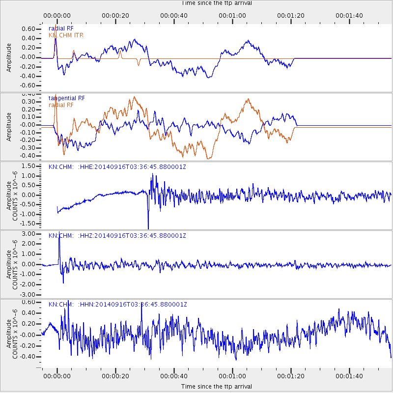
CHM KN.CHM - Earthquake Result Viewer
*The percent match for this event was below the threshold and hence no stack was calculated.
| Earthquake location: |
Eastern Honshu, Japan |
| Earthquake latitude/longitude: |
36.1/139.9 |
| Earthquake time(UTC): |
2014/09/16 (259) 03:28:31 GMT |
| Earthquake Depth: |
54 km |
| Earthquake Magnitude: |
5.6 MB |
| Earthquake Catalog/Contributor: |
NEIC PDE/NEIC COMCAT |
|
| Network: |
KN Kyrgyz Seismic Telemetry Network |
| Station: |
CHM KN.CHM |
| Lat/Lon: |
43.00 N/74.75 E |
| Elevation: |
655 m |
|
| Distance: |
49.6 deg |
| Az: |
299.051 deg |
| Baz: |
74.898 deg |
| Ray Param: |
$rayparam |
*The percent match for this event was below the threshold and hence was not used in the summary stack. |
|
| Radial Match: |
43.715088 % |
| Radial Bump: |
400 |
| Transverse Match: |
28.175776 % |
| Transverse Bump: |
400 |
| SOD ConfigId: |
3390531 |
| Insert Time: |
2019-04-14 02:00:33.716 +0000 |
| GWidth: |
2.5 |
| Max Bumps: |
400 |
| Tol: |
0.001 |
|
Signal To Noise
| Channel | StoN | STA | LTA |
| KN:CHM: :HHZ:20140916T03:36:45.880001Z | 16.63767 | 8.3847516E-7 | 5.039619E-8 |
| KN:CHM: :HHN:20140916T03:36:45.880001Z | 1.5289975 | 2.062328E-7 | 1.3488105E-7 |
| KN:CHM: :HHE:20140916T03:36:45.880001Z | 1.9406818 | 6.1851716E-7 | 3.1871127E-7 |
| Arrivals |
| Ps | |
| PpPs | |
| PsPs/PpSs | |


