You are here: Home > Network List > US - United States National Seismic Network Stations List
> Station EGMT Eagleton, Montana, USA > Earthquake Result Viewer
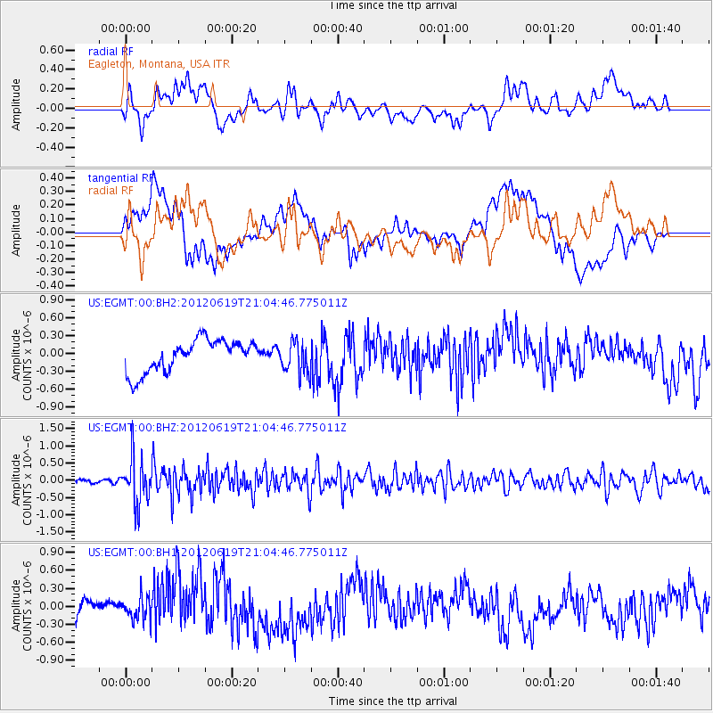
EGMT Eagleton, Montana, USA - Earthquake Result Viewer
*The percent match for this event was below the threshold and hence no stack was calculated.
| Earthquake location: |
Near Islands, Aleutian Islands |
| Earthquake latitude/longitude: |
53.4/171.7 |
| Earthquake time(UTC): |
2012/06/19 (171) 20:56:41 GMT |
| Earthquake Depth: |
12 km |
| Earthquake Magnitude: |
5.9 MB, 5.2 MS, 5.6 MW, 5.7 MW |
| Earthquake Catalog/Contributor: |
WHDF/NEIC |
|
| Network: |
US United States National Seismic Network |
| Station: |
EGMT Eagleton, Montana, USA |
| Lat/Lon: |
48.02 N/109.75 W |
| Elevation: |
1055 m |
|
| Distance: |
47.7 deg |
| Az: |
62.835 deg |
| Baz: |
307.39 deg |
| Ray Param: |
$rayparam |
*The percent match for this event was below the threshold and hence was not used in the summary stack. |
|
| Radial Match: |
35.356037 % |
| Radial Bump: |
400 |
| Transverse Match: |
36.192158 % |
| Transverse Bump: |
400 |
| SOD ConfigId: |
558545 |
| Insert Time: |
2013-09-19 20:58:12.841 +0000 |
| GWidth: |
2.5 |
| Max Bumps: |
400 |
| Tol: |
0.001 |
|
Signal To Noise
| Channel | StoN | STA | LTA |
| US:EGMT:00:BHZ:20120619T21:04:46.775011Z | 9.789774 | 6.750197E-7 | 6.8951515E-8 |
| US:EGMT:00:BH1:20120619T21:04:46.775011Z | 1.2126791 | 2.3353113E-7 | 1.9257453E-7 |
| US:EGMT:00:BH2:20120619T21:04:46.775011Z | 1.0096277 | 2.7094885E-7 | 2.6836508E-7 |
| Arrivals |
| Ps | |
| PpPs | |
| PsPs/PpSs | |


