You are here: Home > Network List > UW - Pacific Northwest Regional Seismic Network Stations List
> Station UMAT Pilot Rock, OR, USA > Earthquake Result Viewer
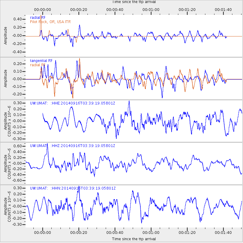
UMAT Pilot Rock, OR, USA - Earthquake Result Viewer
*The percent match for this event was below the threshold and hence no stack was calculated.
| Earthquake location: |
Eastern Honshu, Japan |
| Earthquake latitude/longitude: |
36.1/139.9 |
| Earthquake time(UTC): |
2014/09/16 (259) 03:28:31 GMT |
| Earthquake Depth: |
54 km |
| Earthquake Magnitude: |
5.6 MB |
| Earthquake Catalog/Contributor: |
NEIC PDE/NEIC COMCAT |
|
| Network: |
UW Pacific Northwest Regional Seismic Network |
| Station: |
UMAT Pilot Rock, OR, USA |
| Lat/Lon: |
45.29 N/118.96 W |
| Elevation: |
1318 m |
|
| Distance: |
72.3 deg |
| Az: |
46.638 deg |
| Baz: |
303.435 deg |
| Ray Param: |
$rayparam |
*The percent match for this event was below the threshold and hence was not used in the summary stack. |
|
| Radial Match: |
61.694885 % |
| Radial Bump: |
400 |
| Transverse Match: |
81.042854 % |
| Transverse Bump: |
400 |
| SOD ConfigId: |
3390531 |
| Insert Time: |
2019-04-14 02:03:31.553 +0000 |
| GWidth: |
2.5 |
| Max Bumps: |
400 |
| Tol: |
0.001 |
|
Signal To Noise
| Channel | StoN | STA | LTA |
| UW:UMAT: :HHZ:20140916T03:39:19.05801Z | 2.1953182 | 2.7202282E-7 | 1.2391043E-7 |
| UW:UMAT: :HHN:20140916T03:39:19.05801Z | 1.2810796 | 1.0170726E-7 | 7.939183E-8 |
| UW:UMAT: :HHE:20140916T03:39:19.05801Z | 0.94773936 | 9.4338084E-8 | 9.954012E-8 |
| Arrivals |
| Ps | |
| PpPs | |
| PsPs/PpSs | |


