You are here: Home > Network List > US - United States National Seismic Network Stations List
> Station LAO LASA Array, Montana, USA > Earthquake Result Viewer
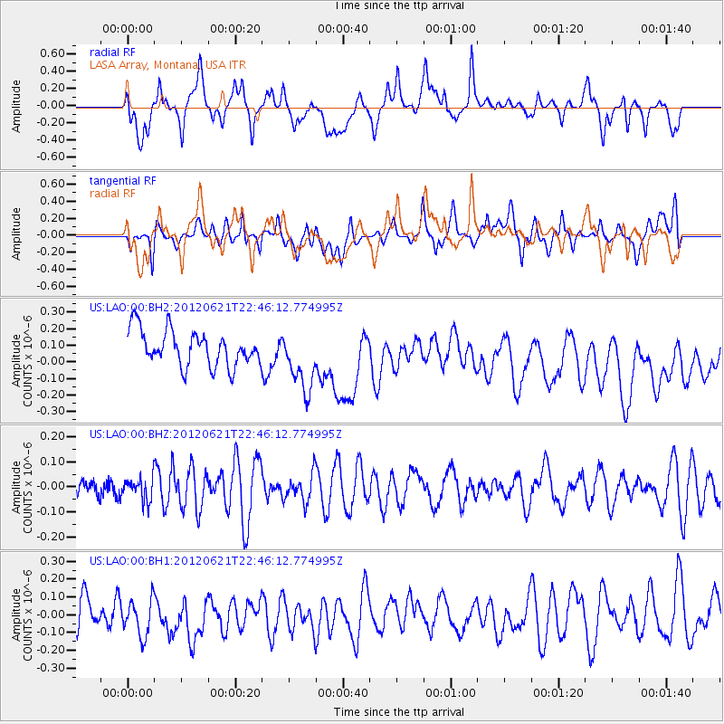
LAO LASA Array, Montana, USA - Earthquake Result Viewer
*The percent match for this event was below the threshold and hence no stack was calculated.
| Earthquake location: |
Fiji Islands Region |
| Earthquake latitude/longitude: |
-18.0/-178.2 |
| Earthquake time(UTC): |
2012/06/21 (173) 22:34:37 GMT |
| Earthquake Depth: |
543 km |
| Earthquake Magnitude: |
5.5 MW, 5.2 MB, 5.5 MW |
| Earthquake Catalog/Contributor: |
WHDF/NEIC |
|
| Network: |
US United States National Seismic Network |
| Station: |
LAO LASA Array, Montana, USA |
| Lat/Lon: |
46.69 N/106.22 W |
| Elevation: |
902 m |
|
| Distance: |
91.1 deg |
| Az: |
40.896 deg |
| Baz: |
244.857 deg |
| Ray Param: |
$rayparam |
*The percent match for this event was below the threshold and hence was not used in the summary stack. |
|
| Radial Match: |
51.018494 % |
| Radial Bump: |
400 |
| Transverse Match: |
50.65707 % |
| Transverse Bump: |
400 |
| SOD ConfigId: |
558545 |
| Insert Time: |
2013-09-19 21:04:44.945 +0000 |
| GWidth: |
2.5 |
| Max Bumps: |
400 |
| Tol: |
0.001 |
|
Signal To Noise
| Channel | StoN | STA | LTA |
| US:LAO:00:BHZ:20120621T22:46:12.774995Z | 0.63715667 | 4.564214E-8 | 7.163409E-8 |
| US:LAO:00:BH1:20120621T22:46:12.774995Z | 1.2753469 | 1.0765178E-7 | 8.44098E-8 |
| US:LAO:00:BH2:20120621T22:46:12.774995Z | 1.7870243 | 1.8954879E-7 | 1.0606951E-7 |
| Arrivals |
| Ps | |
| PpPs | |
| PsPs/PpSs | |


