You are here: Home > Network List > AV - Alaska Volcano Observatory Stations List
> Station MAPS Pakushin Southeast, Makushin Volcano, Alaska > Earthquake Result Viewer
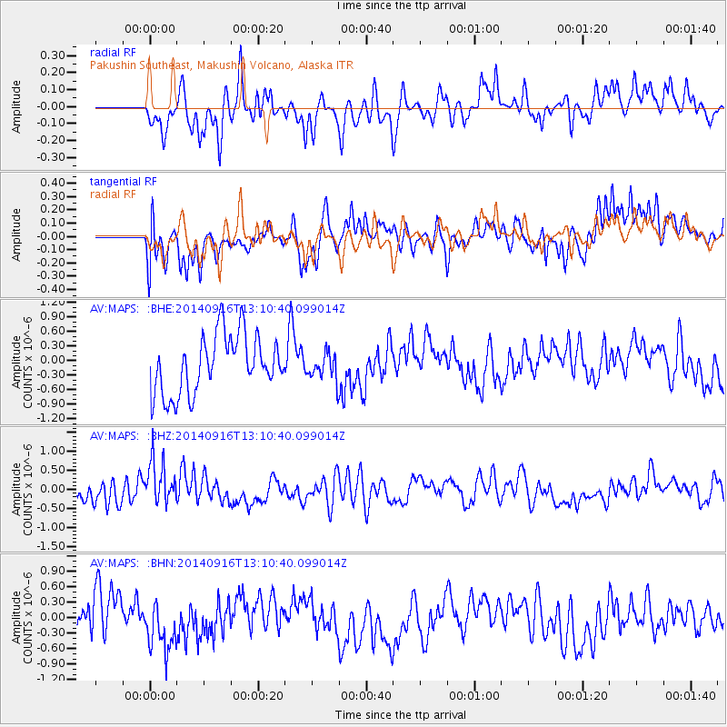
MAPS Pakushin Southeast, Makushin Volcano, Alaska - Earthquake Result Viewer
*The percent match for this event was below the threshold and hence no stack was calculated.
| Earthquake location: |
South Of Fiji Islands |
| Earthquake latitude/longitude: |
-22.3/-179.5 |
| Earthquake time(UTC): |
2014/09/16 (259) 13:00:20 GMT |
| Earthquake Depth: |
585 km |
| Earthquake Magnitude: |
5.5 MW |
| Earthquake Catalog/Contributor: |
ISC/ISC |
|
| Network: |
AV Alaska Volcano Observatory |
| Station: |
MAPS Pakushin Southeast, Makushin Volcano, Alaska |
| Lat/Lon: |
53.81 N/166.94 W |
| Elevation: |
333 m |
|
| Distance: |
76.6 deg |
| Az: |
7.603 deg |
| Baz: |
191.923 deg |
| Ray Param: |
$rayparam |
*The percent match for this event was below the threshold and hence was not used in the summary stack. |
|
| Radial Match: |
52.09633 % |
| Radial Bump: |
400 |
| Transverse Match: |
50.833588 % |
| Transverse Bump: |
400 |
| SOD ConfigId: |
3390531 |
| Insert Time: |
2019-04-14 02:07:37.658 +0000 |
| GWidth: |
2.5 |
| Max Bumps: |
400 |
| Tol: |
0.001 |
|
Signal To Noise
| Channel | StoN | STA | LTA |
| AV:MAPS: :BHZ:20140916T13:10:40.099014Z | 2.1507337 | 5.9377356E-7 | 2.7607953E-7 |
| AV:MAPS: :BHN:20140916T13:10:40.099014Z | 1.2530614 | 4.7593122E-7 | 3.7981476E-7 |
| AV:MAPS: :BHE:20140916T13:10:40.099014Z | 0.48198155 | 2.9083162E-7 | 6.0340824E-7 |
| Arrivals |
| Ps | |
| PpPs | |
| PsPs/PpSs | |


