You are here: Home > Network List > II - Global Seismograph Network (GSN - IRIS/IDA) Stations List
> Station WRAB Tennant Creek, NT, Australia > Earthquake Result Viewer
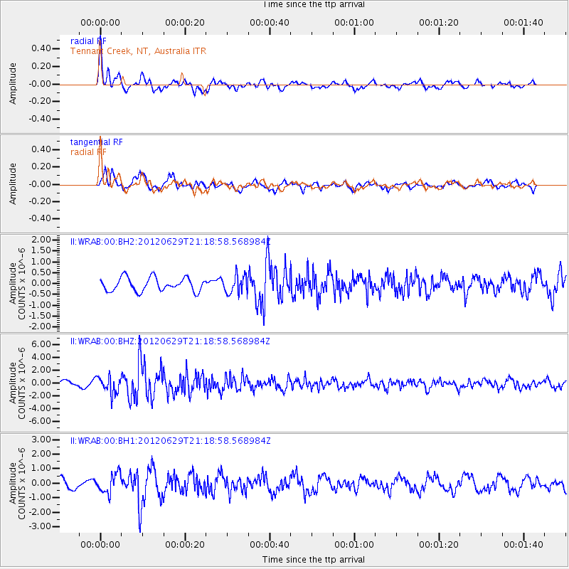
WRAB Tennant Creek, NT, Australia - Earthquake Result Viewer
*The percent match for this event was below the threshold and hence no stack was calculated.
| Earthquake location: |
Northern Xinjiang, China |
| Earthquake latitude/longitude: |
43.4/84.7 |
| Earthquake time(UTC): |
2012/06/29 (181) 21:07:33 GMT |
| Earthquake Depth: |
18 km |
| Earthquake Magnitude: |
6.2 MB, 6.4 MS, 6.3 MW, 6.3 MW |
| Earthquake Catalog/Contributor: |
WHDF/NEIC |
|
| Network: |
II Global Seismograph Network (GSN - IRIS/IDA) |
| Station: |
WRAB Tennant Creek, NT, Australia |
| Lat/Lon: |
19.93 S/134.36 E |
| Elevation: |
366 m |
|
| Distance: |
77.8 deg |
| Az: |
132.802 deg |
| Baz: |
325.382 deg |
| Ray Param: |
$rayparam |
*The percent match for this event was below the threshold and hence was not used in the summary stack. |
|
| Radial Match: |
71.94648 % |
| Radial Bump: |
400 |
| Transverse Match: |
75.94336 % |
| Transverse Bump: |
400 |
| SOD ConfigId: |
558545 |
| Insert Time: |
2013-09-19 21:28:16.285 +0000 |
| GWidth: |
2.5 |
| Max Bumps: |
400 |
| Tol: |
0.001 |
|
Signal To Noise
| Channel | StoN | STA | LTA |
| II:WRAB:00:BHZ:20120629T21:18:58.568984Z | 2.4503403 | 1.3211159E-6 | 5.391561E-7 |
| II:WRAB:00:BH1:20120629T21:18:58.568984Z | 2.0163326 | 6.8382536E-7 | 3.3914313E-7 |
| II:WRAB:00:BH2:20120629T21:18:58.568984Z | 1.3519802 | 4.1655034E-7 | 3.0810386E-7 |
| Arrivals |
| Ps | |
| PpPs | |
| PsPs/PpSs | |


