You are here: Home > Network List > US - United States National Seismic Network Stations List
> Station CBKS Cedar Bluff, Kansas, USA > Earthquake Result Viewer
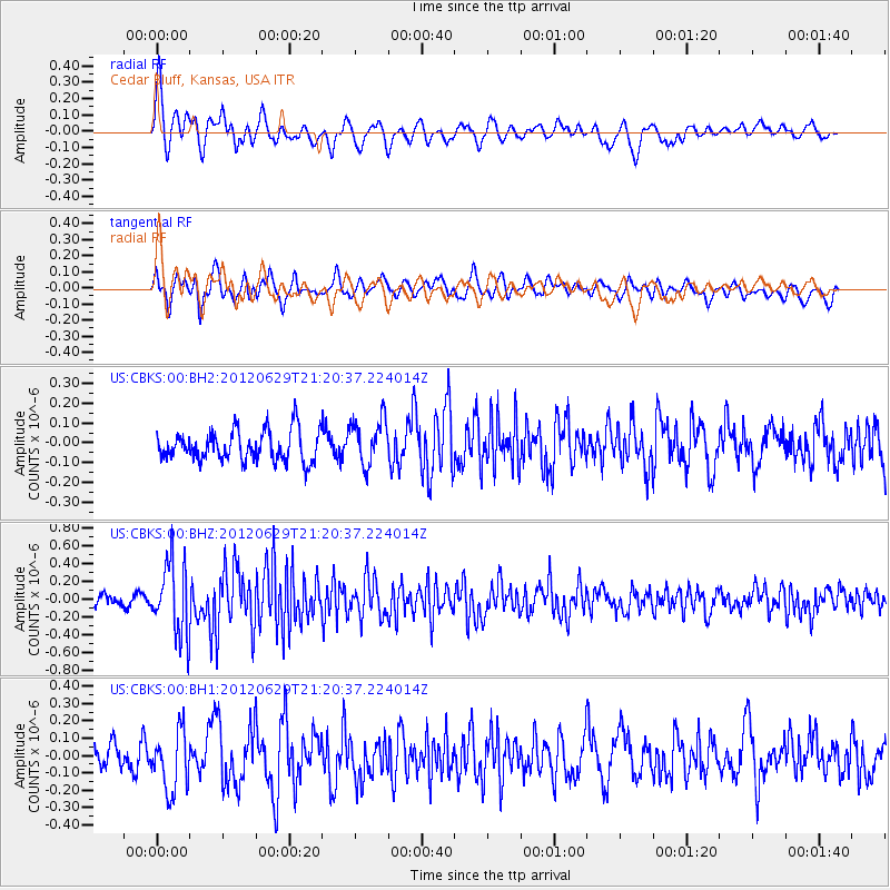
CBKS Cedar Bluff, Kansas, USA - Earthquake Result Viewer
*The percent match for this event was below the threshold and hence no stack was calculated.
| Earthquake location: |
Northern Xinjiang, China |
| Earthquake latitude/longitude: |
43.4/84.7 |
| Earthquake time(UTC): |
2012/06/29 (181) 21:07:33 GMT |
| Earthquake Depth: |
18 km |
| Earthquake Magnitude: |
6.2 MB, 6.4 MS, 6.3 MW, 6.3 MW |
| Earthquake Catalog/Contributor: |
WHDF/NEIC |
|
| Network: |
US United States National Seismic Network |
| Station: |
CBKS Cedar Bluff, Kansas, USA |
| Lat/Lon: |
38.81 N/99.74 W |
| Elevation: |
677 m |
|
| Distance: |
98.0 deg |
| Az: |
3.5 deg |
| Baz: |
356.737 deg |
| Ray Param: |
$rayparam |
*The percent match for this event was below the threshold and hence was not used in the summary stack. |
|
| Radial Match: |
63.23493 % |
| Radial Bump: |
400 |
| Transverse Match: |
63.610226 % |
| Transverse Bump: |
400 |
| SOD ConfigId: |
558545 |
| Insert Time: |
2013-09-19 21:29:29.816 +0000 |
| GWidth: |
2.5 |
| Max Bumps: |
400 |
| Tol: |
0.001 |
|
Signal To Noise
| Channel | StoN | STA | LTA |
| US:CBKS:00:BHZ:20120629T21:20:37.224014Z | 6.525138 | 4.107394E-7 | 6.294724E-8 |
| US:CBKS:00:BH1:20120629T21:20:37.224014Z | 2.3631167 | 1.7824888E-7 | 7.542957E-8 |
| US:CBKS:00:BH2:20120629T21:20:37.224014Z | 1.5546957 | 1.1857606E-7 | 7.626963E-8 |
| Arrivals |
| Ps | |
| PpPs | |
| PsPs/PpSs | |


